

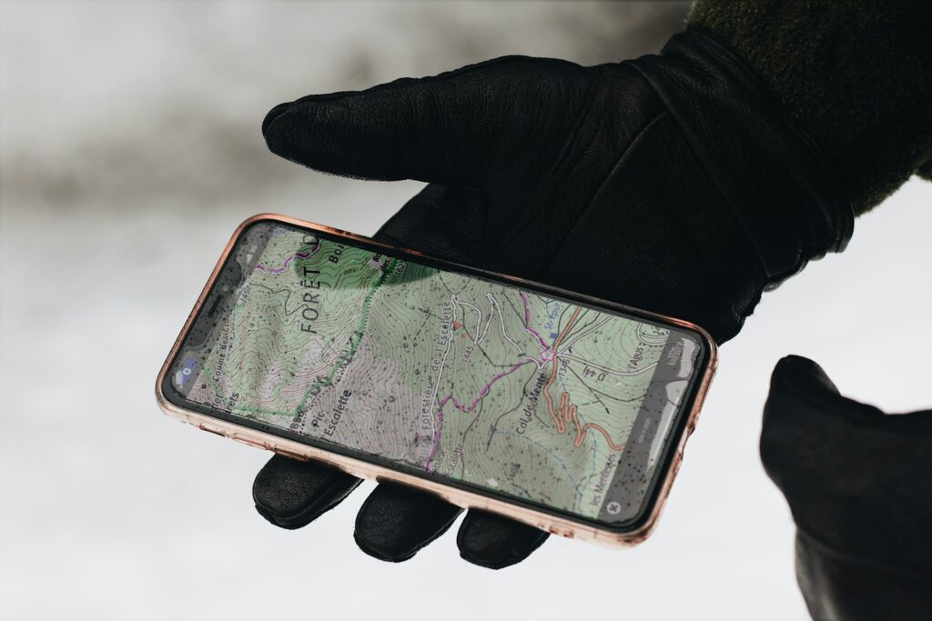
The global landscape of navigation is undergoing a seismic shift, and as we push deeper into 2025, the once-unquestioned reliance on traditional GPS systems is rapidly proving to be insufficient. At this year’s Mobile World Congress, a pervasive frustration echoed throughout the bustling halls: GPS just wasn’t delivering the consistent, reliable performance we’ve all come to expect. From faltering navigation apps to struggling ride-hailing services, the glitches were undeniable, even for seasoned U.S. and international regulators.
Thankfully, for those attendees in Barcelona, these disruptions were mere inconveniences, not life-threatening emergencies. Yet, this collective experience serves as a stark reminder of the profound vulnerabilities inherent in Global Navigation Satellite Systems (GNSS) like GPS. While GPS stands as a remarkable innovation and a cornerstone of modern infrastructure, supporting everything from national security to global logistics, its satellite-based architecture presents critical weaknesses that demand a reevaluation of our dependence.
This in-depth look will explore the 14 fundamental systems and approaches that, by 2025, can no longer be trusted as primary navigation solutions. We’ll delve into the inherent fragilities of the core GPS system, from its susceptibility to environmental factors and intentional interference to its performance shortcomings in diverse environments. Furthermore, we will dissect specific car navigation systems that have failed to keep pace with technological advancements, leaving drivers at a disadvantage. Understanding these limitations is not merely about convenience; it’s about bolstering our safety, security, and economic resilience in an increasingly connected world.
1. **Reliance on a Singular GPS System: The Peril of a Single Point of Failure**One of the most critical vulnerabilities in our modern infrastructure is the United States’ overwhelming dependence on a singular GPS system for Positioning, Navigation, and Timing (PNT) services. This system, operated by the U.S. government, forms the backbone for an incredibly vast array of sectors, including national security, public safety, energy, agriculture, telecommunications, and global logistics. This centralized control, while a testament to technological prowess, introduces a dangerous single point of failure.
This singular reliance means that any widespread disruption to GPS could have catastrophic and far-reaching consequences. The potential economic fallout alone is staggering, with GPS supporting more than $1.4 trillion in economic activity. A significant outage could lead to costs skyrocketing to $1.6 billion per day, impacting everything from financial transactions to transportation networks and emergency response capabilities. The economic and security risks associated with this unlayered approach are immense and cannot be overstated.
Recognizing this precarious position, there’s a growing consensus among government and industry officials for a more resilient approach. The call is for a “layered, ‘system of systems'” that integrates both space- and terrestrial-based technologies. This diversification would provide essential redundancy, ensuring that critical infrastructure remains operational even if the primary satellite-based system faces degradation or unavailability. Public support for creating a ground-based GPS backup system is also strong, with over 80% of Americans agreeing it’s essential for public safety and national security.
2. **GPS Limitations in Dense Urban Environments: When Skyscrapers Turn into Signal Blockers**Despite its global reach, the satellite-based GPS system often struggles immensely in dense urban environments. Cities characterized by towering buildings made of concrete and steel present significant challenges to GPS signal reception. These structures act as formidable barriers, blocking or distorting the weak satellite signals as they attempt to reach our devices on the ground. The signals, traveling over 12,500 miles, arrive incredibly weak, making them highly susceptible to such physical interference.
Experiences in places like Barcelona and New York City vividly illustrate this problem. Navigation apps that work flawlessly in open areas can falter dramatically amidst skyscrapers, leading to inaccurate positioning and frustrating delays. This degradation isn’t merely an inconvenience for ride-hailing services or individuals trying to find their way; it can have serious implications for emergency responders who require precise location data in complex urban labyrinths. The urban canyon effect significantly compromises the reliability of GPS.
In these challenging urban landscapes, terrestrial, or ground-based, PNT systems offer a vital solution. These alternative systems transmit signals that are orders of magnitude stronger than satellite signals, enabling them to penetrate dense urban structures more effectively. By providing secure, accurate timing and location data where satellite-based systems fall short, they serve as a critical complement, enhancing the overall resilience of navigation services in our most populated areas. Such ground-based solutions are becoming indispensable for urban navigation.
3. **The Blackout Indoors and Underground: Why GPS Fails When You Need It Most**Beyond the concrete jungles of dense cities, GPS faces an even more fundamental challenge: its inability to function reliably indoors or in subterranean environments. When you step inside a large building, a high-rise office complex, or descend into a subway tunnel, the GPS signal typically vanishes. This is a direct consequence of the nature of satellite signals, which are not designed to penetrate thick building materials or large masses of earth and rock.
For everyday users, this means navigating indoor parking garages, large shopping malls, or extensive public transit systems without the aid of a precise location. For critical services, the implications are far more severe. Emergency responders operating within large buildings, underground facilities, or in urban infrastructure like subway tunnels cannot depend on GPS for accurate positioning, potentially compromising search and rescue operations or vital coordination efforts. This gap in coverage is a significant limitation of satellite-only navigation.
This crucial deficiency underscores the urgent need for ground-based PNT systems. These systems are specifically designed to deliver robust and accurate location data in scenarios where satellite signals are inherently unavailable or severely degraded. They provide the necessary redundancy for critical infrastructure and public safety, ensuring that precise positioning and timing information is accessible even in the most challenging indoor and underground environments. Without such a backup, these spaces remain navigation black holes.
4. **Vulnerability to Physical Obstructions: The Simple Blockers That Halt Complex Navigation**Even outside dense urban areas, the inherent weakness of GPS signals makes them vulnerable to various physical obstructions. While skyscrapers are obvious culprits, a multitude of less prominent physical barriers can also degrade or completely block signals. Natural terrain features such as mountains, deep valleys, or even dense foliage can interfere with the line of sight required for effective satellite reception. Large vehicles, tunnels, or even overhead bridges can momentarily or persistently obscure the weak signals.
Because GPS signals travel vast distances – over 12,500 miles – they arrive at Earth’s surface with extremely low power. This makes them highly susceptible to any form of physical impedance. A simple overpass might cause a temporary loss of signal, leading to a missed turn or delayed instructions on a navigation app. In more critical applications, such as precision agriculture or drone operations, even minor physical obstructions can lead to significant operational errors or safety hazards, demonstrating the fragility of relying solely on an unobstructed sky view.
The consequence of this vulnerability is a less reliable and often frustrating user experience, particularly in dynamic environments where obstructions are common. Modern navigation requires consistent, uninterrupted data, and physical obstructions present a continuous threat to this consistency for satellite-only systems. The need for complementary systems that can overcome these common physical challenges is therefore paramount to ensuring robust navigation in all real-world conditions.
5. **Disruption by Solar Activity: Navigating Cosmic Interference**Beyond man-made and terrestrial obstructions, GPS signals are also surprisingly susceptible to natural phenomena originating far beyond Earth: solar activity. Events such as solar flares and coronal mass ejections can release vast amounts of energy and charged particles, impacting Earth’s ionosphere. As GPS signals traverse the ionosphere, these disturbances can cause signal distortion, degradation, or even complete outages.
The effects of solar activity are largely unpredictable and beyond human control, yet they can severely compromise the accuracy and availability of GPS services. For instance, a strong solar storm could lead to widespread inaccuracies in positioning, affecting everything from commercial aviation to scientific research that relies on highly precise timing data. Such interference highlights an inherent vulnerability that cannot be mitigated through ground-based infrastructure alone, emphasizing the need for robust system redundancy and awareness of space weather.
While major solar events are infrequent, their potential impact underscores the fragility of relying on a single, space-based system. The unpredictability and global nature of solar interference mean that even with perfect ground conditions, GPS can still be compromised by cosmic forces. This aspect further solidifies the argument for a layered approach to PNT, one that can maintain functionality even when space-based signals are temporarily or significantly affected by celestial phenomena.
6. **The Threat of Intentional GPS Jamming: When Signals Are Deliberately Silenced**In an increasingly complex geopolitical landscape, the threat of intentional GPS jamming has escalated from theoretical concern to a documented reality. GPS jamming involves the deliberate emission of radio signals designed to overwhelm and disrupt legitimate GPS signals, effectively creating a “denial of service” for navigation and timing. This malevolent act can render GPS receivers useless, causing them to lose their fix or provide inaccurate data, thereby disrupting critical operations.
Recent global events, particularly the war in Ukraine, have brought this threat into sharp focus. Jamming incidents are now routinely disrupting flights and disabling automated farming equipment across vast swathes of the continent. Sites like gpsjam.org provide real-time visualizations of this interference, showcasing the widespread and persistent nature of these attacks. The economic and strategic implications of such disruptions are profound, affecting everything from military operations to civilian infrastructure and logistics.
This intentional interference poses a direct challenge to national security and public safety. Without resilient backup systems, nations relying solely on GPS are highly vulnerable to these deliberate attacks. The capability to jam GPS signals is becoming more accessible, making the need for robust, ground-based PNT complements not just a convenience, but a strategic imperative. These backup systems can provide a reliable source of PNT when satellite signals are intentionally silenced, protecting critical functions.
7. **The Danger of GPS Spoofing: Deceiving Your Location Data**Beyond jamming, which aims to block GPS signals, an even more insidious threat exists: GPS spoofing. Spoofing involves transmitting false GPS signals that mimic legitimate ones, effectively deceiving a receiver into calculating an incorrect position or time. Instead of merely losing a signal, a device subjected to spoofing will operate under the false premise that it is in a different location or that the time is incorrect, potentially leading to catastrophic consequences.
The context explicitly states that “GPS jamming and spoofing are no longer theoretical.” This means that sophisticated actors are actively employing these techniques. For instance, automated farming equipment has been disabled across the continent due to such threats. Imagine autonomous vehicles being fed false location data, or critical infrastructure systems relying on precise timing being manipulated. The potential for misdirection and operational chaos is immense, far exceeding the impact of a simple signal loss.
Spoofing attacks are particularly dangerous because they can be difficult to detect, as receivers may continue to report a position, albeit an erroneous one. This silent deception can lead to grave errors in navigation, timing, and synchronization across industries. Therefore, reliance on a single GPS source, vulnerable to such sophisticated attacks, is a risk no modern society should bear. The development of robust, ground-based PNT systems is crucial to provide verifiable and trusted location and timing data, safeguarding against these advanced forms of digital warfare and ensuring operational integrity.
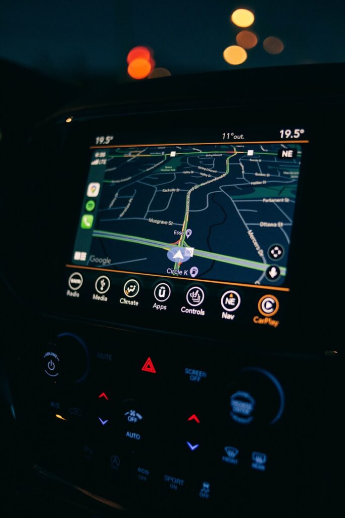
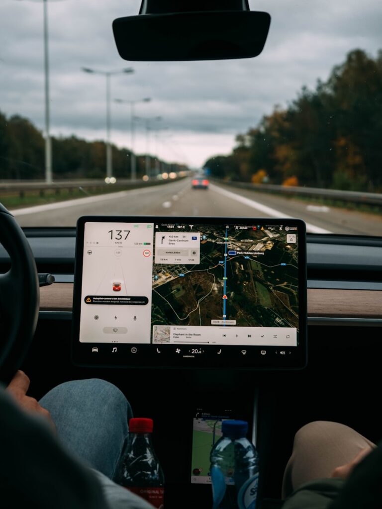
While the core GPS infrastructure faces monumental challenges, as we’ve seen, many drivers are also navigating with another layer of outdated technology: their factory-installed car navigation systems. These older in-car systems often suffer from significant deficiencies that render them unreliable and impractical for modern demands in 2025. As technology accelerates, the gap between what’s available and what’s embedded in older vehicles becomes a chasm, affecting everything from efficiency to safety on the road.
This section will delve into specific car navigation systems that have failed to keep pace, along with broader technological shortcomings that make reliance on them a distinct disadvantage today. Understanding these systems, and why they no longer meet expectations, is crucial for anyone still depending on them or considering a used vehicle with such a setup.
8. **Chevrolet MyLink (Pre-2018 Models)**Chevrolet’s MyLink system, particularly in models produced before 2018, has rapidly fallen behind in terms of navigation functionality by 2025. When MyLink was first introduced, it represented a significant step forward in infotainment for Chevrolet vehicles. However, it has struggled to keep pace with the rapidly advancing technological landscape, making it a system drivers should no longer rely upon for primary navigation.
The primary issue with MyLink in older vehicles is its outdated interface. It feels clunky and unintuitive compared to modern systems, with menus that are slow to respond and a touchscreen that can be difficult to navigate while driving, leading to unnecessary distractions. The graphics also lack the sharpness and clarity found in newer systems, making maps harder to read and navigation prompts less clear, especially in challenging lighting conditions or complex urban environments.
Adding to its obsolescence, older MyLink systems suffer from a critical lack of regular updates. Unlike contemporary infotainment systems that receive over-the-air software and map updates, pre-2018 MyLink models simply do not have these capabilities. This means drivers are stuck with outdated maps, which frequently lead to incorrect or inefficient routing, especially in dynamic, fast-changing urban environments. The absence of real-time traffic information – such as construction zones, accidents, or road closures – further exacerbates the problem, leaving drivers unaware of more efficient routes until it’s too late.
Perhaps the most significant drawback for modern drivers is MyLink’s profound lack of smartphone integration. While newer Chevrolet models have wisely integrated Apple CarPlay and Android Auto, MyLink in pre-2018 models entirely lacks this feature. This absence severely limits access to popular, superior navigation apps like Google Maps and Waze, which offer live traffic updates, advanced route planning, and more detailed, crowd-sourced map data. Consequently, the MyLink system in older Chevrolets delivers a subpar navigation experience, proving increasingly impractical in 2025.
9. **Nissan NissanConnect (Pre-2020 Models)**NissanConnect, especially in models produced before 2020, has seen a dramatic decline in its utility and relevance by 2025. While initially lauded for its modern features upon introduction, older iterations of NissanConnect have definitively failed to keep up with the relentless pace of advancements in navigation and infotainment technology, rendering them largely obsolete for today’s drivers.
One of the most pressing issues with these older NissanConnect systems is their outdated interface. The screen layout feels neither sleek nor responsive compared to contemporary systems, and the touch controls can be sluggish, often requiring more input and patience than is acceptable while driving. This makes it particularly challenging for drivers to quickly access navigation features or adjust settings, which can compromise focus on the road. Furthermore, the system’s graphics are frequently blurry and difficult to read, making it arduous to follow directions at a glance, especially in complex or unfamiliar territories.
A significant limitation of the pre-2020 NissanConnect system is its complete lack of real-time traffic data. Unlike newer models that have embraced cloud-based navigation systems integrating live traffic updates, these older NissanConnect versions simply do not offer this crucial functionality. Drivers are left with static, outdated map data that cannot account for real-time road conditions, traffic jams, or unexpected reroutes. Without dynamic rerouting based on live traffic, drivers often find themselves stuck in preventable congestion, leading to wasted time and increased frustration.
Adding to its diminishing viability in 2025, older NissanConnect systems critically lack robust smartphone integration. While more recent versions have begun to offer Apple CarPlay and Android Auto, older models do not possess this essential capability. This limitation directly prevents drivers from seamlessly using their smartphones to access superior navigation apps like Waze or Google Maps, which consistently provide better route planning, real-time traffic updates, and alternative route suggestions. Given the rapid evolution and widespread adoption of these smartphone apps, the absence of such features in older NissanConnect systems makes them increasingly impractical for modern drivers.
10. **Hyundai Blue Link (Pre-2021 Models)**Hyundai’s Blue Link system, particularly in pre-2021 models, has become significantly outdated by 2025, largely due to its profound inability to keep pace with the latest technological demands. Although Blue Link’s navigation system was once considered a forward-thinking step for Hyundai, as the years have passed, it has increasingly lagged behind its competitors, offering a frustrating experience rather than a reliable guide.
The user interface, while functional at its initial release, is now widely considered clunky and challenging to navigate, especially when benchmarked against the sleek, intuitive systems that dominate the automotive market today. The touchscreen responsiveness is often sluggish, demanding more time and attention to operate, which can be a dangerous distraction while driving. In an era where ease of use and instant feedback are paramount, this slow and cumbersome experience renders Blue Link a poor choice for drivers in 2025.
Beyond its lackluster interface, the pre-2021 Blue Link system struggles considerably with providing accurate and genuinely up-to-date navigation information. It consistently lacks the level of detail and real-time accuracy that modern drivers expect from an effective navigation tool. For instance, while newer systems dynamically update maps and integrate real-time traffic information, Blue Link systems from earlier years simply do not possess these capabilities. This means drivers relying on Blue Link are often using outdated maps, making it difficult to navigate through bustling cities or avoid unforeseen roadblocks caused by accidents or construction. Without the benefit of real-time updates, drivers are left with an inherently unreliable tool for traversing the complex road networks of 2025.
Furthermore, Blue Link’s significant lack of integration with Apple CarPlay and Android Auto makes it a particularly tough sell for tech-savvy users who have become accustomed to the seamless navigation experience these popular apps provide. The absence of smartphone integration severely limits access to third-party navigation services like Google Maps, Waze, or Apple Maps, all of which offer demonstrably superior functionality than the outdated Blue Link system. At a time when most drivers expect to effortlessly connect their smartphones to their vehicle’s infotainment system, Blue Link’s lack of compatibility with these essential apps makes it increasingly irrelevant and frustrating to use.
11. **Mazda Connect (Pre-2020 Models)**Mazda’s Connect system, specifically in vehicles produced before 2020, stands out as one of the more obsolete navigation systems by 2025. Although it was viewed as innovative upon its initial release, the system now feels distinctly outdated and cumbersome compared to the multitude of newer alternatives available. Its interface, while functional, decidedly lacks the modern aesthetics and intuitive user-friendliness that contemporary drivers now expect from their in-car technology.
The screens often respond slowly, and the navigation system itself operates with less fluidity and responsiveness than more advanced models. The graphical quality of its maps is also notably low when compared to current systems, which can make reading directions at a quick glance a genuine challenge, especially in complex driving environments such as busy downtown areas or rural regions characterized by winding, unfamiliar roads. This visual and operational sluggishness detracts significantly from the driving experience.
One of the most substantial challenges with older Mazda Connect systems is their critical inability to provide real-time traffic information. Modern navigation systems are heavily reliant on live updates to consistently ensure drivers are on the most efficient and least congested route. However, Mazda Connect’s pre-2020 models are fundamentally incapable of accessing real-time data on traffic conditions, road closures, or accidents. As a direct result, drivers using these older systems frequently find themselves unexpectedly stuck in traffic or routed through frustrating detours without any prior warning. This profound lack of dynamic rerouting based on current conditions constitutes a significant disadvantage, preventing drivers from adjusting their paths to avoid delays and leading to inefficient, and often frustrating, driving experiences.
Furthermore, older Mazda Connect models crucially lack integration with key smartphone features like Apple CarPlay and Android Auto. This means drivers cannot access the navigation apps that have become the gold standard in modern vehicles, such as Google Maps or Waze. These widely used apps provide superior routing algorithms, real-time updates, and significantly more accurate directions than the built-in Mazda Connect system. The absence of this essential smartphone connectivity makes the system feel profoundly outdated and functionally limited, leaving drivers without the flexibility and versatility they have rightfully come to expect from modern infotainment systems in 2025.
12. **Kia UVO (Pre-2020 Models)**Kia’s UVO system, particularly in vehicles manufactured before 2020, has proven to be increasingly ineffective as a primary navigation tool by 2025. While it offered competitive features at its introduction, the pre-2020 versions of UVO have simply failed to keep pace with the rapid advancements in navigation technology, leaving them far behind the curve. Its user interface, though simple, now feels distinctly outdated and conspicuously lacks the fluidity and responsiveness characteristic of more modern systems.
Drivers frequently find themselves frustrated by the system’s slower response times, transforming what should be simple tasks like setting a destination or searching for a point of interest into a cumbersome chore. In direct comparison to newer navigation systems, UVO’s interface looks and feels significantly behind the times, invariably contributing to a subpar driving experience that modern users will quickly find intolerable. The overall user interaction feels antiquated in today’s fast-paced automotive landscape.
Perhaps one of the most critical issues plaguing older UVO systems is their fundamental lack of real-time traffic updates. Unlike contemporary systems that maintain constant connectivity to live data feeds, UVO’s navigation system in older vehicles is unable to update traffic conditions, road closures, or construction zones dynamically. This means that drivers relying on UVO are often navigating with outdated information, which invariably leads to avoidable delays and inefficient routes. In an era where accurate, up-to-date traffic data is an absolute necessity, UVO’s failure to offer this level of insight makes it a decidedly poor choice for modern drivers in 2025.
Moreover, Kia’s pre-2020 UVO systems conspicuously lack integration with Apple CarPlay and Android Auto, two features that have become virtually standard in almost every new vehicle on the market. The absence of these essential smartphone integration features severely limits access to superior modern navigation apps, such as Google Maps and Waze, which provide dramatically better functionality, more detailed information, and crucial real-time updates than UVO’s built-in navigation. As a direct consequence, drivers are forced to depend on a less efficient, outdated system, making UVO in older Kia vehicles a less-than-ideal, indeed almost unacceptable, choice for contemporary navigation in 2025.

13. **Factory Systems Lacking Dynamic Real-Time Traffic Updates**Beyond specific brand names, a pervasive and debilitating technological deficiency rendering many older factory-installed car navigation systems obsolete in 2025 is their fundamental inability to provide dynamic real-time traffic updates. In a world where road conditions can change in minutes, relying on static, pre-loaded map data is akin to navigating with an antique compass in a digital age. This absence of live information dramatically impacts the efficiency and reliability of any navigation system.
The consequences of this limitation are significant and widespread. Drivers with systems lacking real-time data frequently find themselves unexpectedly ensnared in traffic jams, forced into frustrating detours due to unannounced construction, or belatedly confronted by accident scenes they could have easily avoided. This not only leads to wasted time and fuel but also contributes to increased driver stress and distraction, directly impacting safety. Without the ability to dynamically reroute based on current conditions, these systems transform from helpful guides into sources of frustration, unable to adapt to the unpredictable nature of modern roadways.
Modern navigation systems, by contrast, leverage sophisticated cloud-based services and often crowd-sourced data to offer truly dynamic routing. They continuously monitor traffic flows, factor in road closures, and even predict congestion based on historical patterns, presenting drivers with the most efficient path forward. Older systems, built on pre-internet or rudimentary connected car architectures, simply cannot replicate this level of intelligence and responsiveness. Their limitations are not just about missing a single feature; they represent a fundamental architectural deficiency that cannot be overcome without a complete overhaul, making them deeply impractical for today’s drivers.
As drivers prioritize efficiency and seamless experiences, the expectation for intelligent, adaptive navigation has become universal. Any system that cannot offer this foundational capability inherently falls short. The lack of dynamic real-time traffic updates isn’t merely a minor inconvenience; it’s a core flaw that undermines the very purpose of a navigation system in 2025, pushing drivers to seek alternative, more capable solutions—often on their smartphones—that can genuinely keep pace with the world around them.
Read more about: Navigating the Digital Road: Which Car Infotainment System Is Easiest to Use in 2025?
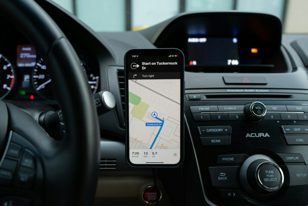
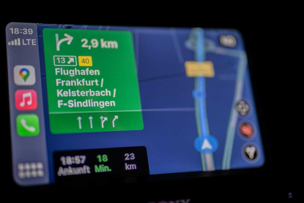
14. **In-Car Navigation Without Seamless Smartphone Integration**Another critical technological deficiency that has rendered numerous older factory-installed navigation systems unreliable and impractical by 2025 is their conspicuous lack of seamless smartphone integration. In an era where personal smartphones have become indispensable tools for virtually every aspect of daily life, including navigation, an in-car system that cannot effortlessly connect with these devices is inherently incomplete and frustratingly limited. The advent and widespread adoption of platforms like Apple CarPlay and Android Auto have set a new benchmark for what drivers expect from their infotainment and navigation experience.
The absence of these integration features isolates older in-car systems from a vast ecosystem of superior application functionality. Popular navigation apps such as Waze, Google Maps, and Apple Maps offer capabilities that older built-in systems simply cannot match: superior route planning algorithms, crowd-sourced real-time updates, voice-guided directions that benefit from continuous software improvements, and access to a wider range of points of interest. Drivers relying solely on an older system are effectively cut off from these advancements, forced to juggle their phone for navigation or endure a significantly less capable built-in alternative.
This gap in functionality profoundly impacts the user experience. Instead of a cohesive, intuitive interface displayed on the vehicle’s large screen, drivers are often reduced to fumbling with their phones for directions, which poses a serious safety risk due to distraction. Furthermore, without smartphone integration, the vehicle’s navigation system becomes a static, isolated component, unable to leverage the constant evolution and user-driven improvements that characterize modern mobile applications. This makes the system not just inconvenient, but fundamentally less intelligent and less useful than readily available smartphone solutions.
Ultimately, a navigation system in 2025 that lacks seamless smartphone integration represents a significant practical disadvantage. It fails to meet the fundamental expectations of modern drivers who anticipate their vehicle’s technology will work harmoniously with their personal devices. This deficiency underscores why many older in-car navigation systems have become obsolete, pushing drivers towards third-party solutions that are consistently updated, more feature-rich, and, crucially, integrate flawlessly into their connected lives, offering the flexibility and versatility that is now a basic requirement for contemporary navigation.
As we journey deeper into 2025, the landscape of navigation systems is undergoing an unrelenting transformation, driven by an escalating demand for accuracy, real-time intelligence, and robust resilience. The limitations of traditional GPS, alongside the glaring deficiencies of many older factory-installed car navigation units, paint a clear picture: sole reliance on these basic systems is no longer a viable option for navigating our increasingly complex world.
The future of navigation demands a multi-layered, interconnected approach. It requires ground-based PNT systems to complement satellite signals, ensuring continuity in urban canyons and underground spaces, and safeguarding against jamming and spoofing. Simultaneously, in-car systems must evolve, moving beyond static maps and clunky interfaces to embrace dynamic real-time updates, seamless smartphone integration, and intuitive user experiences.
Read more about: Escape the Digital Dash: 14 Cars and Strategies for a Touchscreen-Free Driving Experience in 2024
Manufacturers that champion continuous innovation, embracing cloud-based services, advanced AI, and tight integration with the digital lives of drivers, will be the ones guiding us forward. Those that cling to outdated architectures and neglect essential updates will see their systems fade into obsolescence, leaving drivers quite literally lost. The path ahead is clear: for truly reliable, efficient, and safe navigation, we must move beyond the basic and embrace the intelligent, resilient systems that define the cutting edge of 2025 and beyond. It’s about empowering drivers, ensuring critical infrastructure, and safeguarding against a world where a single signal is no longer enough.


