

In the sprawling landscape of the United States, our highways represent both the arteries of commerce and the veins of our adventures, connecting communities and enabling journeys across vast distances. Yet, beneath the convenience of these long stretches of asphalt and concrete lies a stark reality: many of these roads harbor significant dangers, turning routine trips into perilous endeavors. It’s a complex interplay of design, driver behavior, and environmental factors that transform ordinary pavement into something truly treacherous.
When we talk about dangerous roads, it’s easy to immediately think of high fatality counts. While these grim statistics are undeniably crucial, the true measure of a highway’s hazard extends far beyond just deaths. Frequent crashes and accidents, even those without fatalities, inflict serious injuries, cause untold stress, and leave a significant dent in our insurance premiums. The sheer frequency of these incidents matters immensely, as a driver who uses a high-risk highway daily sees their chances of encountering trouble escalate significantly.
This in-depth look will guide you through 12 of America’s most challenging roads, shedding light on the unique threats each presents. We’ll explore everything from the explicit danger of sinkholes and deteriorating infrastructure to the hidden perils of icy conditions, dense fog, and the pressures of heavy traffic. Understanding these specific risks, and why they make certain routes exceptionally dangerous, can equip every driver with the knowledge to navigate more safely or, perhaps, to choose an alternate path altogether. So, buckle up as we journey into the heart of America’s most hazardous highways.

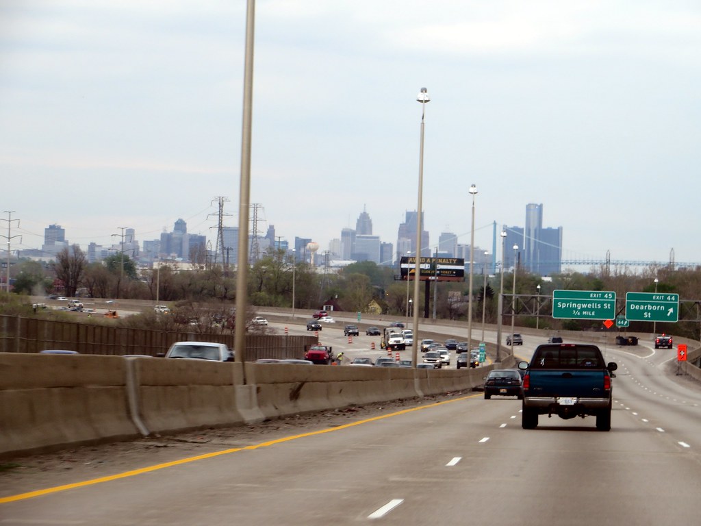
1. **Interstate 80 (I-80): A Highway Plagued by Sinkholes and Disrepair**While I-80 is celebrated for its iconic truck stops, making it a favorite for cross-country road trippers, it also carries a somber reputation for danger. This lengthy interstate winds through multiple states, and notably, parts of it are in a concerning state of disrepair. This isn’t just about minor potholes or cracks; we’re talking about significant structural failures that demand immediate attention.
As recently as March 2025, sections of I-80 in New Jersey were forced to close, specifically because of the critical need for repairs due to sinkholes. This isn’t a new problem; these geological hazards have been plaguing the New Jersey segment of the highway for many years, raising questions about whether they can ever be fully resolved. The conditions became so dire that the mayor had to declare a state of emergency, unequivocally marking this stretch as too dangerous for regular travel.
The presence of sinkholes on I-80 highlights a deeper vulnerability in our infrastructure, where geological instability meets persistent wear and tear. It’s a chilling reminder that the ground beneath our wheels isn’t always as solid as we assume. The ongoing struggle to keep these sections safe, coupled with the fact that I-80 isn’t even New Jersey’s deadliest road, should prompt reasonable concern about the overall state of roadways in the region.
Beyond these specific localized dangers, I-80 also records a moderate number of average annual fatalities across five different states. Nebraska and Wyoming, for example, each claim over 20 deaths annually on this interstate. In 2019 alone, the total number of fatalities on I-80 exceeded 200, and it holds the regrettable distinction of having the 10 deadliest miles in both Nevada and Pennsylvania, with over 60 deaths in each of those states.

2. **U.S. Route 1 (US-1), Florida: The Sunshine State’s Sinking Sensation**Without a shadow of a doubt, U.S. Route 1 stands out as one of the most perilous routes in the entire country. On average, it accounts for 108 fatalities annually, and a staggering over 1,000 deaths have occurred on this single highway over the last decade. This chilling data firmly plants US-1 on any list of America’s most dangerous roads, though its most critical risks are heavily concentrated in one particular state.
The sole, albeit small, saving grace of this highway is that the vast majority of its danger, risk, and tragic outcomes begin and end in Florida. While fatalities do occur on US-1 in Maryland and Maine, the annual numbers in those states generally don’t surpass 15, which actually makes it a relatively safer road in those regions. Indeed, if it weren’t for the overwhelming impact Florida has on the overall statistics, US-1 might not even be considered for a list of America’s most dangerous roads.
What makes the Florida segment of US-1 so exceptionally dangerous? The context points to frequent accidents due to a combination of factors, including troublesome potholes and a distinct lack of shoulders. Furthermore, its exposure to severe weather conditions exacerbates these issues, turning routine drives into high-stakes gambles. A unique challenge for this highway is that it ends up crossing the ocean in certain parts, particularly as it winds through the Florida Keys. This means if you veer off the road in these sections, getting back on isn’t just difficult, it’s virtually impossible, adding an extreme layer of risk to an already hazardous journey.
X user @KeyWestLocal vividly shares their experience, noting, “US-1 is a racetrack for some, a panic attack for others. Those Keys bridges are terrifying.” This sentiment perfectly captures the dual nature of the highway: its straight stretches, unfortunately, encourage speeding, while the narrow bridges leading to the Keys are inherently intimidating to many drivers. The sheer volume of heavy tourist traffic, combined with urban congestion in Miami-Dade County, further amplifies the risks, making this a truly challenging route to navigate.
In recent years, commendable efforts have been made to curb the number of crashes on US-1 in other states. For instance, Philadelphia has strategically added speed cameras to the route, a proactive measure designed to discourage dangerous driving behaviors. However, the situation in Florida remains persistently risky, demanding continued vigilance from both authorities and drivers alike.
3. **Interstate 75 (I-75): A Journey Through Winter Woes and Truck Troubles**Much like its western counterpart, I-5, Interstate 75 has earned a reputation for danger, primarily because of its status in specific, challenging areas. This major north-south artery holds the unenviable title for having the 10 deadliest miles of any highway in Michigan. Between 2000 and 2019, this short but dangerous stretch of road saw nearly 80 crashes, highlighting its consistent peril in the Great Lake State.
Unlike I-5, however, the dangers associated with I-75 tend to stretch a bit further down its extensive path. A significant contributing factor to its perilous nature is the tendency for sections of the highway to ice over during the harsh winter months, especially in its northern reaches. These slippery conditions dramatically reduce traction and control, making winter driving on I-75 exceptionally hazardous. Keeping a close eye on ways to avoid winter car troubles, such as preparing your tires and windshield for the cold weather, is absolutely essential for anyone traveling through these northern parts.
The southern segments of I-75, particularly through Florida, present a different but equally formidable set of challenges. Here, heavy truck traffic becomes a primary concern, contributing significantly to the highway’s overall risk profile. In 2019 alone, a staggering 237 fatalities were recorded across the entire stretch of I-75, from the Great Lakes all the way down to Florida. This sheer volume of heavy vehicles, often interacting with denser traffic, creates an environment ripe for accidents.
Due to the high frequency of heavier vehicles on its southern portions, it’s highly advisable for drivers to take a closer look at car brands that boast the best safety ratings. An exceptionally safe car, even if you find yourself in a difficult situation involving a larger truck, is far more likely to emerge from that predicament with minimal risks, offering a crucial layer of protection on this often-congested and challenging interstate. The combination of environmental factors like ice and the constant flow of commercial vehicles ensures I-75 remains a route demanding extreme caution.
4. **Interstate 5 (I-5): The West Coast’s Deadly Corridor**Interstate 5, the major north-south artery that spans nearly the entire western U.S., has garnered a particularly grim reputation in Washington state, where it is known as one of the deadliest highways. Over the past decade and more, this interstate has been the scene of over 240 crashes, with more than 70 of these tragic incidents occurring within a particularly lethal 10-mile stretch. While its annual fatality count may not always surpass some other highways, an average of 26 lives are still lost on I-5 each year, a number that certainly warrants serious concern.
One of the most infamous incidents on I-5 occurred in 1991, involving a massive pile-up triggered by an unexpected dust storm. This catastrophic event led to 164 cars crashing due to the severely low visibility conditions created by the storm. What’s particularly interesting, and perhaps a stark reminder of the highway’s widespread dangers, is that while I-5’s hazards are predominantly recognized in Washington, this specific multi-car accident unfolded in California.
Fortunately, the Washington portion of I-5 has not experienced anything on the same scale as that historic dust storm incident. Nevertheless, the frequent occurrence of crashes in more recent times, driven by a myriad of factors, has persistently kept I-5 labeled as a relatively dangerous road. Its extensive length, cutting through major California counties like Los Angeles and San Diego, coupled with high traffic volumes, contribute significantly to its high crash numbers and overall risk.
The sheer volume of daily trips on I-5, connecting bustling urban centers and serving as a critical freight corridor, means that even a small percentage of risky driving behaviors or adverse conditions can lead to a high number of incidents. It serves as a continuous reminder that vigilance is paramount when traversing this vital, yet often unforgiving, West Coast route.

5. **Interstate 15 (I-15): A Tale of Two States and Trucker Troubles**Interstate 15’s unenviable reputation for danger stems not from one state, but prominently from two: Utah and Nevada. In both these regions, I-15 has witnessed more crashes within a 10-mile radius than any other highway crossing those areas. For Nevada, the crash count in such a stretch can reach as high as 60, while Utah manages to keep its numbers a bit lower, at 37 incidents.
Even when looking at the data from just one recent year, the picture remains concerning. In 2019 alone, nearly 160 fatalities occurred across the entirety of I-15. This translates to a tragic reality where, during that year, at least 11 people lost their lives for every 100 miles of this sprawling road. These statistics paint a clear picture of a highway where dangers are consistently present along significant portions of its route.
In recent years, I-15 has been specifically identified as an especially hazardous road for truckers. Many drivers attribute the blame not necessarily to the highway’s design itself, but rather to the behaviors of those sharing the road with them. Alcohol abuse and excessive speed are frequently reported as major problems, creating an unpredictable and dangerous environment for commercial and private vehicles alike. While neither Nevada nor Utah are particularly known for widespread issues with drunk driving, it’s crucial to remember that I-15 also traverses Montana, a state that has recently been flagged as one of the worst when it comes to drivers operating under the influence.
This combination of high traffic volumes, particularly commercial traffic, and the persistent issue of risky driver behavior underscores the complexity of I-15’s dangers. From its bustling urban stretches to its more remote segments, the highway demands constant awareness from all who travel on it, especially when considering the potentially fatal consequences of impaired or overly aggressive driving.
6. **Interstate 20 (I-20): The Triple Crown of Deadliest Miles**Depending on who you ask, Interstate 20 is often regarded as a top contender for a highway you’d be wise to avoid at all costs. The statistics supporting this view are certainly alarming. In 2019, I-20 was linked to over 200 fatalities, a sobering number that places it squarely among the nation’s most dangerous roads. What’s more, it holds the grim distinction of claiming the ’10 deadliest miles’ crown in not one, but three different states: Alabama, Georgia, and Mississippi.
So, what makes I-20 so exceptionally dangerous? Several factors have been identified as culprits. Issues with high volumes of traffic are a constant challenge, leading to congestion and increased opportunities for accidents. Incidents of road rage are also frequently noted, where driver frustration escalates into dangerous maneuvers. Furthermore, a perceived lack of decent signage and inadequate lighting at night contribute significantly to hazardous driving conditions, especially during the darker hours.
For those who find themselves on I-20 during the late hours, it becomes absolutely critical to keep track of ways to improve visibility when driving at night. A simple failure of headlights on a poorly lit section could mean there’s not enough ambient light nearby to warn you of an imminent accident, turning a routine night drive into a potentially fatal situation. The confluence of these varied factors makes I-20 a highway where extreme caution is not just advised, but essential.” , “_words_section1”: “1965

7. **Interstate 35 (I-35): The Urban Gauntlet of Texas**Interstate 35 is another highway that shares some of the same risk factors as I-20, particularly in its grim distinction of claiming the “10 deadliest miles” title in three different states. However, the exact nature of its perils often varies by region, with its presence in Iowa and Kansas showing relatively lower numbers of fatalities—around 29 in Iowa and 34 in Kansas—suggesting that the danger isn’t uniform across its vast length.
Yet, the true core of I-35’s problems lies undeniably in Texas. This particular segment of the highway holds the unenviable record for having the most fatal crashes within a 10-mile radius of any highway in the entire U.S. between the years 2000 and 2019. During that period, a staggering total of over 140 such incidents were recorded, unequivocally marking this relatively short portion of the road as exceptionally threatening and a constant source of concern for drivers.
A major contributing factor to this extreme danger is the sheer density of the population it serves. I-35 impressively covers three of America’s most populated cities: Austin, Dallas, and San Antonio. The constant flow of traffic through these bustling urban centers creates an environment where congestion is the norm, and the sheer volume of vehicles dramatically increases the opportunities for collisions and accidents to occur.
It’s no surprise, then, that with such a large number of cars converging on a single highway, the statistics for crashes are so alarmingly high. The daily pressure of navigating dense traffic, combined with the inherent challenges of urban driving, ensures that I-35 remains a highway demanding unwavering vigilance and patience from every motorist who travels its path, especially through the heart of Texas.
8. **U.S. Route 83 (US-83): Texas’s Rural and Remote Peril**Unfortunately for drivers in the Lone Star State, I-35 isn’t the only road that poses significant risks. U.S. Route 83, one of the few roads on this list that isn’t an interstate highway, stands out as the most dangerous highway in Texas, recording an average of 34 fatalities each year. Over the past decade, this route has seen its number of crashes surpass 260, with only a handful of other roads in the country exhibiting higher rates.
From 2015 to 2019, US-83 tragically accounted for nearly 140 deaths per 100 fatal crashes, with a significant concentration of these incidents occurring in Webb County. Unlike the bustling urban corridors of I-35, the danger of US-83 isn’t always immediately obvious to the average driver, as it runs right through the heart of Texas, often traversing vast, sparsely populated areas.
This seemingly tranquil setting, however, might be precisely what makes it so dangerous. With fewer cars to contend with in these low-population regions, drivers might be tempted to speed down the seemingly empty roads. This increased velocity, coupled with the potential for unexpected hazards, can lead to high-speed crashes that might otherwise be avoidable, turning what appears to be a clear stretch of road into a high-stakes gamble.
The highway continues to maintain a pretty bad reputation, with at least one death occurring almost every other week on this route. X user @TexasRangerX vividly notes, “US-83 feels like the Wild West. No lights, no barriers, just you and the trucks.” This sentiment perfectly captures the stark reality of driving on US-83, where the lack of infrastructure and the prevalence of heavy truck traffic create a uniquely hazardous environment.
Furthermore, the isolated nature of many stretches of US-83 means that emergency services may not be as readily available or as quick to respond as they would be in more populated areas. This delay can exacerbate the outcomes of accidents, turning what might have been survivable incidents into tragic fatalities, adding another layer of risk to this remote and challenging thoroughfare.
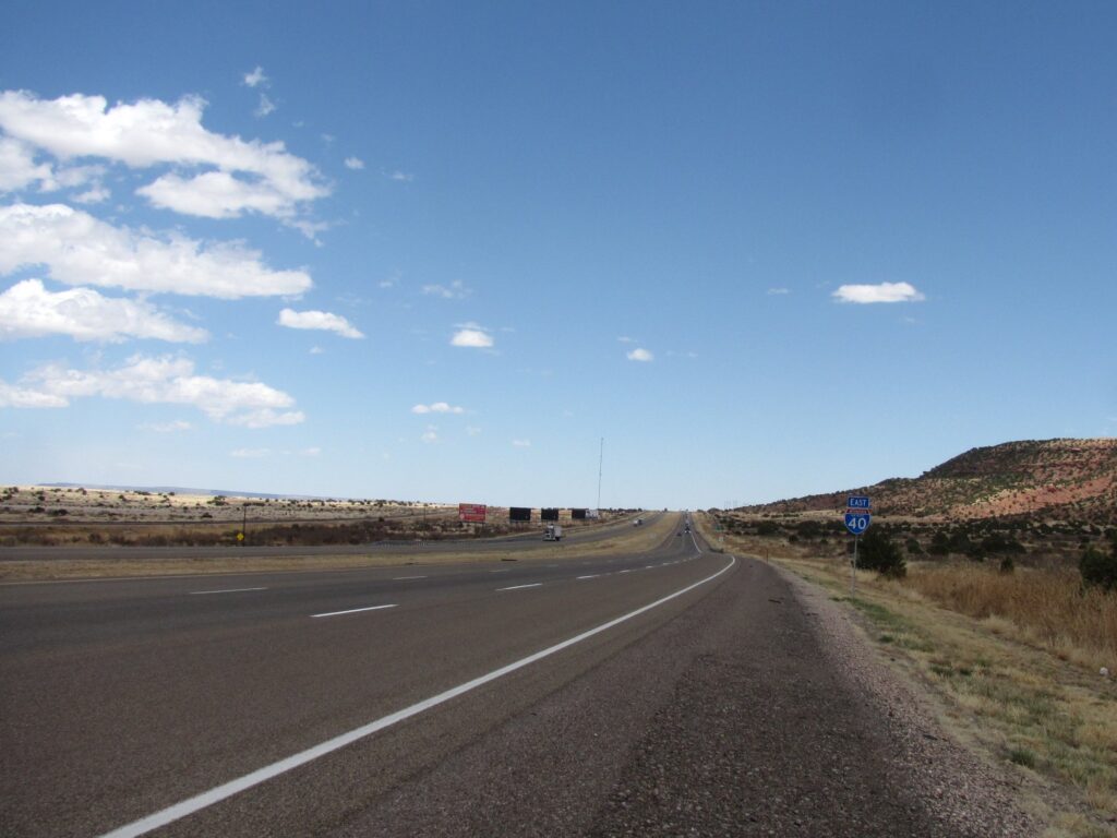
9. **Interstate 40 (I-40): The Cannonball Run’s Costly Legacy**Interstate 40 is a highway with a dual reputation: some might recognize it from legendary cannonball run records, a testament to its long, open stretches, while others know it as one of the highways with the most annual fatalities. Its presence in Tennessee alone accounts for an average of 52 deaths each year, with Arizona and New Mexico contributing 35 and 40 fatalities, respectively, highlighting its widespread impact across multiple states.
However, where the statistics become exceptionally worrying is in its 2019 data. In that single year, I-40 stood out as one of the few highways to suffer from over 1,000 fatal crashes across multiple states it traverses. This alarming figure underscores the consistent, pervasive danger present along significant portions of this major east-west interstate, demanding attention from every driver.
Numerous factors converge to make I-40 exceptionally dangerous. High population density in urban areas it passes through contributes to congestion and accident risk. Excessive speeding is a frequently cited problem, amplifying the force of collisions. Additionally, the highway features numerous hills and windy stretches of road, which can lead to very problematic driving conditions, particularly for those unfamiliar with the terrain or during adverse weather.
Considering the often unexpected cost of advanced car safety systems, many drivers may not have the financial means to equip their vehicles with features that could help offset these inherent highway issues. This can inadvertently force them into greater risks simply because they have no other choice. For these individuals, if alternate roads are available, it might be best to avoid I-40 altogether to minimize exposure to its multifaceted hazards.

10. **Interstate 95 (I-95): The East Coast’s Congested Gauntlet**While the title of the deadliest interstate can be a competitive one, Interstate 95 is certainly a strong contender, consistently appearing on lists of America’s most perilous roads. It suffered from the most fatalities in 2019, with over 280 tragic deaths recorded along its immense stretch. The data further reveals a chilling statistic: 24 people lost their lives in just a single mile on I-95 between 2000 and 2019, indicating areas of extreme, concentrated risk.
I-95 also holds the unenviable crown for containing Florida’s 10 deadliest miles, a stretch that saw 132 fatal crashes and 135 deaths from 2000 to 2019. In terms of frequency, this interstate is an especially crash-prone highway, with its high traffic volume and long distances creating a constant environment ripe for incidents, from minor fender-benders to catastrophic collisions.
While I-95 shares many of its risks with other dangerous roads, such as high traffic and speeding, its sheer length introduces a unique and significant factor: a lack of sufficient rest areas. This oversight can lead to driver fatigue, an understated but profoundly dangerous contributor to accidents. Prolonged periods behind the wheel without adequate breaks can impair judgment and reaction times as easily as other notorious risky behaviors.
Sometimes, the dangers on I-95 extend beyond typical road conditions or driver behavior. For example, Ford’s answer to autopilot technology falling under federal investigation after crash deaths on I-95 shows how risky a road can be, even when not directly accounting for reckless drivers or perilous terrain. Such incidents highlight the multifaceted challenges that make this long, bustling East Coast artery a highway demanding utmost caution.

11. **U.S. Route 2 (US-2): The Northern Route’s Icy Isolation**U.S. Route 2, a sprawling highway that stretches from Washington state all the way to Maine, presents a distinct set of dangers, particularly in its northern segments through Montana and North Dakota. From 2016 to 2019, this route tragically averaged 0.541 deaths per mile, a sobering indicator of the persistent risks faced by those who traverse its often remote and challenging terrain.
The specific factors contributing to US-2’s hazardous reputation in these northern states include severe icy winter conditions, which dramatically reduce traction and control, making driving perilous. Additionally, its remote stretches mean limited access to emergency services, and frequent wildlife crossings pose an ever-present, unpredictable threat. Narrow lanes and limited passing zones further increase the risk of head-on collisions, especially when drivers attempt to overtake slower vehicles.
This isolation and harsh environment are perfectly captured by X user @MontanaTraveler, who warns, “US-2 in winter is a death wish. Ice, deer, and no cell signal for miles.” This sentiment underscores the brutal reality for drivers, where environmental hazards combine with a lack of modern amenities to create exceptionally dangerous conditions.
Ultimately, the highway’s isolation significantly amplifies its inherent dangers. When accidents do occur, the sparse emergency response in these vast, rural areas means that help may be hours away, turning what might otherwise be a manageable incident into a critical, life-threatening situation. US-2 serves as a stark reminder that some of America’s most dangerous roads are not always found in its busiest urban centers, but often in its quietest, most unforgiving landscapes.
12. **California State Route 99 (SR-99): The Central Valley’s Foggy Hazard**California State Route 99, cutting through the agricultural heartland of California’s Central Valley, stands as one of the state’s deadliest highways. In 2018 alone, it recorded a staggering 309 fatalities, with an alarming rate of 62 deaths per 100 miles. These statistics firmly place SR-99 among the most perilous routes in the nation, demanding extreme caution from every driver.
Several contributing factors coalesce to make this route particularly treacherous. Heavy truck traffic, essential for transporting agricultural goods, is a constant presence, increasing the likelihood of severe collisions. The highway’s proximity to agricultural activity can also lead to debris on the road or slow-moving farm vehicles. Moreover, the Central Valley is frequently enveloped in dense fog, especially during certain seasons, which can dramatically reduce visibility to near zero.
The challenges presented by these conditions are frequently echoed by local drivers. X user @ValleyDriver vividly complains, “SR-99 is a fog trap. Can’t see a thing, and trucks don’t slow down.” This firsthand account highlights the terrifying reality of navigating this highway when visibility is compromised, and the presence of large commercial vehicles adds another layer of anxiety.
Indeed, the combination of poor visibility due to fog and the immense volume of both commercial and passenger traffic makes this route inherently treacherous. Even under clear skies, the sheer number of vehicles and the pace of travel demand constant alertness. When adverse weather conditions like dense fog descend, SR-99 transforms into a truly high-risk thoroughfare where even minor misjudgments can lead to severe consequences.
As we’ve journeyed through America’s most dangerous highways, from the sinkhole-prone stretches of I-80 to the remote, icy expanses of US-2 and the fog-laden agricultural corridors of SR-99, a clear picture emerges: road safety is a multifaceted challenge. It’s an intricate dance between highway design, environmental conditions, and, perhaps most crucially, driver behavior. While the statistics can be sobering, there’s a vital takeaway: knowledge is power, and vigilance is our greatest defense.
It’s encouraging to note that significant investments, such as those spurred by the Infrastructure Investment and Jobs Act, are beginning to yield tangible results, with roads across the U.S. showing improvements in condition. These ongoing efforts in infrastructure development, coupled with public awareness campaigns promoting safer driving, lay a strong foundation for reducing accidents and saving lives. Every driver has a role to play in this collective endeavor. By staying informed, remaining alert, and practicing responsible driving habits—avoiding distractions, adhering to speed limits, and never driving under the influence—we can collectively navigate these challenging roads more safely, transforming perilous journeys into secure passages. Drive safe out there; your life, and the lives of others, depend on it.


