

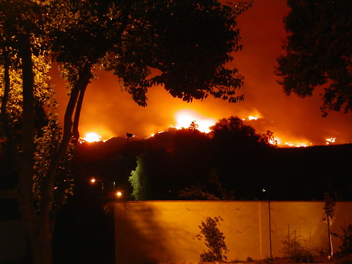
Southern California is currently facing a formidable adversary in the form of the Canyon Fire, a rapidly advancing vegetation blaze that erupted on Thursday afternoon, August 7, shortly before 1:30 p.m. PT.
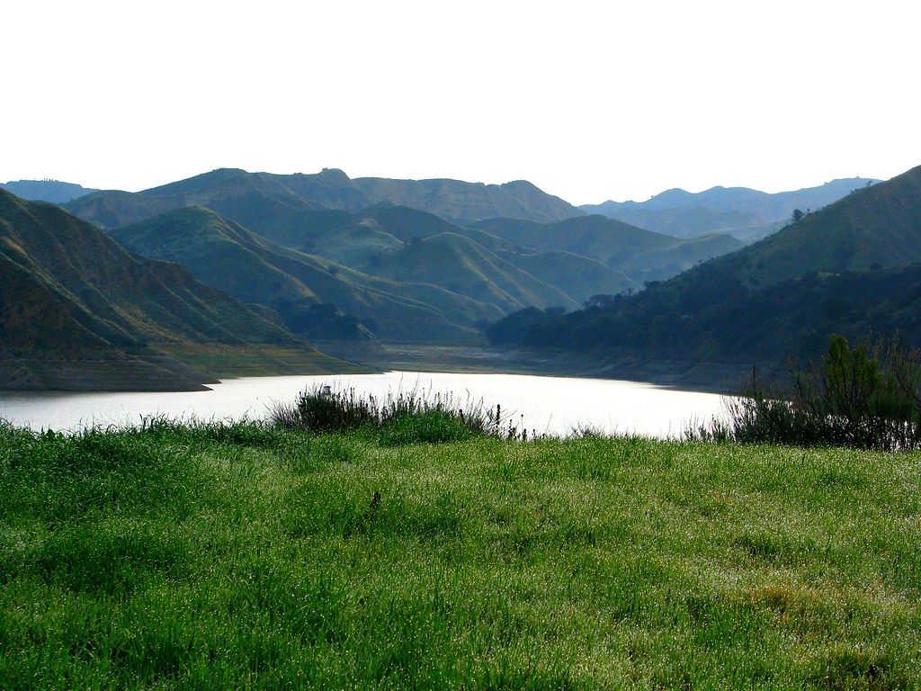
This dynamic fire, which started near Holser Canyon north of the Piru community, has swiftly expanded its reach, threatening both Ventura and Los Angeles counties. The name “Canyon Fire” itself vividly describes the dramatic landscape where this incident unfolds, as a canyon is fundamentally defined as “a deep narrow valley with steep sides and often with a stream flowing through it,” a geological feature that profoundly shapes the challenges faced by firefighters.
The initial reports indicated the fire had consumed roughly 30 acres, a figure that dramatically escalated to 1,051 acres by 4 p.m., and was mapped at a staggering 4,856 acres by 9:30 p.m. on Thursday. This rapid growth, signifying over 2.3 square miles or 6 square kilometers in just five hours, highlights the sheer intensity and unyielding nature of the blaze.
As of late Thursday afternoon, the Canyon Fire remained at zero percent containment, a testament to its aggressive spread east toward the Castaic area. Firefighters worked tirelessly through the night, deploying water and retardant-dropping aircraft, as the flames pushed relentlessly away from the community of Piru and towards scattered ranch homes.

This relentless eastward movement led the fire to cross into Los Angeles County, with the head of the blaze becoming most active in the Hasley Canyon area. The fire poses significant threats, not only to power lines crucial for regional infrastructure but also to the very fabric of communities such as Hasley Canyon and Hathaway Ranch.
In response to the fire’s escalating threat, a swift and decisive wave of evacuation orders and warnings swept across affected zones in both Ventura and Los Angeles counties. Authorities prioritized public safety, urging residents to leave without hesitation.
In Ventura County, five distinct zones were immediately placed under an evacuation order, including the entirety of the Lake Piru Recreation Area, stretching east to the Los Angeles County line, north of Highway 126, and west to Center Street. Additionally, two zones, northwest and northeast of Lake Piru, received an evacuation warning, signaling residents to prepare for potential departure.
The local rural area, though not densely populated, saw 56 individuals evacuated from the Lake Piru recreation area, reflecting the direct impact on those closest to the burgeoning inferno. The Ventura County Sheriff’s Office of Emergency Services has provided an interactive map at vcemergency.com for residents seeking detailed information on these evacuation zones.
Across the county line in Los Angeles, authorities also acted decisively, issuing evacuation orders for Val Verde, Oak Canyon, Hasley Canyon, and Romero Canyons, encompassing five critical zones. An additional six zones were placed under evacuation warning, though areas within the Val Verde zone were later reduced to a warning, indicating a dynamic and responsive situation.
The scope of these evacuations is substantial; according to the LA County Fire Department, at least 4,200 residents across both Los Angeles and Ventura counties were under mandatory evacuation orders. This included approximately 1,400 structures under an order and an additional 12,500 residents under an evacuation warning in LA County alone, underscoring the broad impact of the blaze.
Providing crucial support to displaced residents, an evacuation shelter was promptly established at College of the Canyons, located at the school’s East Gymnasium in Santa Clarita. For those with furry or hooved family members, provisions were made: large animals could be evacuated to Pierce College in Woodland Hills, while smaller animals found refuge at the Castaic Animal Care Center and Agoura Hills Animal Shelter.
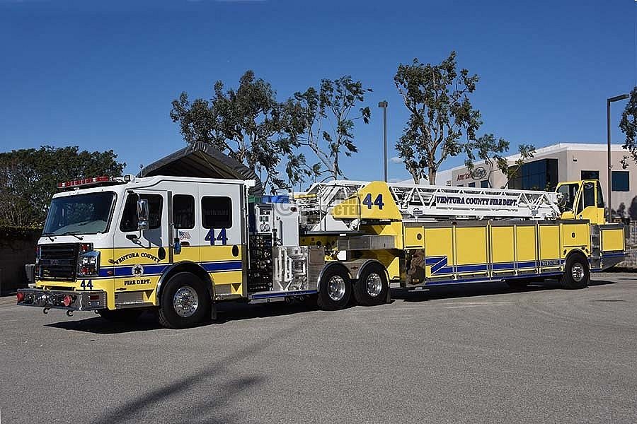
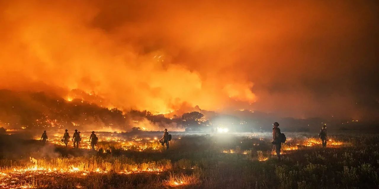
The unified command of the Ventura County Fire Department and the LA County Fire Department is a powerful example of inter-agency cooperation, showcasing a truly impressive and coordinated response to a shared threat. Approximately 600 dedicated individuals have been assigned to this incident, a testament to the scale of the challenge and the unwavering commitment to public safety.
Among these heroic individuals are 250 firefighters on the ground, battling flames across steep and rugged terrain. These crews are working with incredible determination, navigating challenging topography that defines these canyon landscapes. Their tireless efforts are truly inspiring.
Aerial support plays an absolutely critical role in this firefighting ballet, with seven helicopters and multiple fixed-wing aircraft, including several air tankers, providing vital assistance. These magnificent machines are continuously dropping water and retardant on the flames, strategically refilling at Lake Piru, a reservoir conveniently located in the Los Padres National Forest northwest of Los Angeles.
The conditions under which these brave men and women operate are nothing short of extreme. Temperatures in the area have soared to between 90 and 100 degrees, coupled with dangerously low humidity levels of 15 to 20 percent. Adding to the peril are winds gusting up to 25 mph, which fan the flames and accelerate the fire’s spread across the very dry fuels.
The very landscape itself, characterized by deep canyons, further compounds the firefighting challenge. Canyons, often formed by processes of “long-time erosion from a plateau or table-land level,” present natural conduits for fire spread, with their “steep walls” and “rugged terrain” making ground access incredibly difficult. The cliffs within these canyons form because “harder rock strata that are resistant to erosion and weathering remain exposed on the valley walls,” creating formidable natural barriers and pathways for flames.
It is fascinating to consider that canyons are “much more common in arid areas than in wet areas because physical weathering has a more localized effect in arid zones.” This inherent aridity contributes to the dry fuel conditions that allow fires like the Canyon Fire to spread with such alarming speed. The geological process of “frost wedging,” where water seeps into cracks and freezes, pushing rocks apart, also plays a role in shaping these formidable structures, though it doesn’t directly contribute to the fire’s immediate cause.
While the Canyon Fire captivates our immediate attention, it is important to understand that this is not an isolated incident. This brush fire is one of at least four major wildfires actively burning across Southern California this week, underscoring the widespread threat faced by the region.
The Gold Fire, raging in the San Bernardino National Forest, was estimated at more than 1,000 acres early Thursday. Further south, the Gifford Fire, impacting Santa Barbara and San Luis Obispo counties, had swelled to a staggering 96,106 acres by Thursday, or 154 square miles, with only 15% containment. This immense blaze, which grew out of at least four smaller fires, has already injured four people and stands as the state’s largest wildfire of the year.
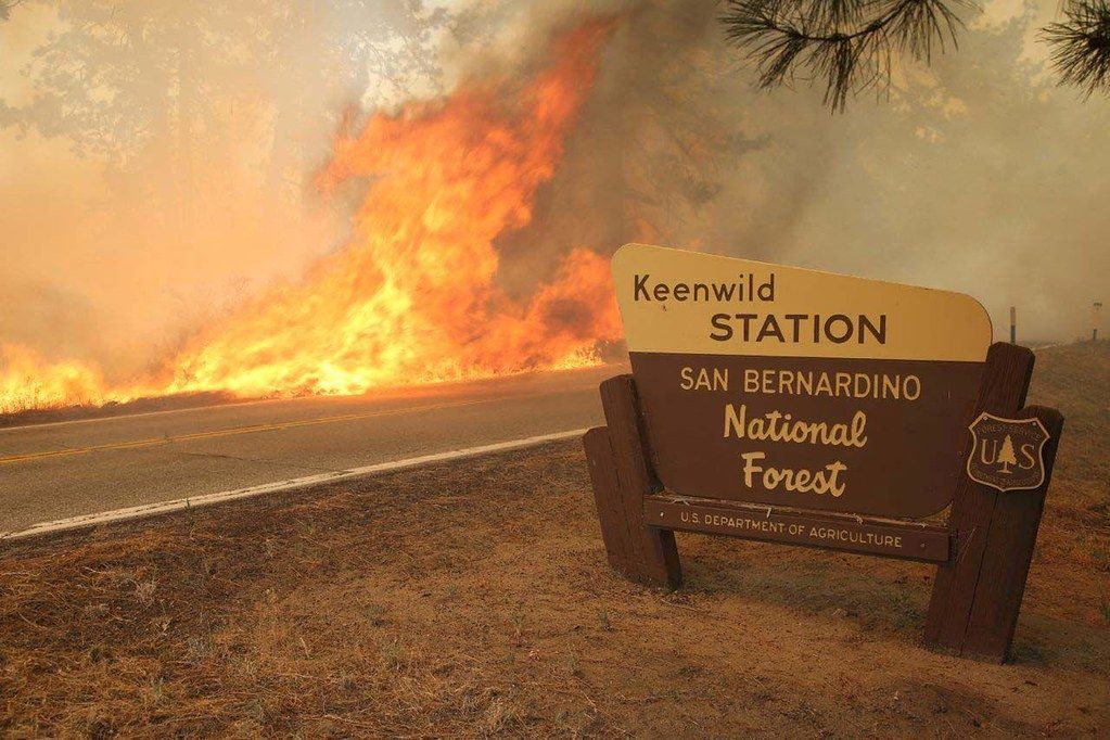
Adding to the challenge, the Rosa Fire, which ignited last Monday in the San Bernardino National Forest between Anza and Pinyon Pines, had grown to nearly 1,700 acres by Thursday. These simultaneous events stretch firefighting resources and highlight the pressing need for vigilance.
Looking at the broader picture, California’s wildfire season has seen a concerning escalation. This year, “more than 4,400 wildfires have been reported,” a significant increase from the 3,800 reported at this time last year. The acreage burned tells an even starker story: “More than 221,100 acres have burned this year,” well beyond the 83,200 acres consumed through July 2024.
Even compared to the five-year average for this period—4,100 fires and 125,700 acres burned—this year’s numbers demonstrate an alarming trend. Nationwide, the National Interagency Fire Center reports that “42,342 wildfires have burned over 3.4 million acres” in 2025, with firefighters currently battling 36 large fires across the country, including several within California.
The outlook for wildfire risk remains elevated through the weekend across much of inland California, as a persistent heat wave intensifies its grip on the area. Historically, August and September are the most dangerous months for wildfires in the state, driven by “persistent drought, high grass loads, and weakening coastal moisture” in Southern California.
In addition to the immediate threat of flames, the Canyon Fire has prompted an air quality watch issued by the Ventura County Air Pollution Control District. The blaze has the potential to create unhealthy air conditions overnight, particularly affecting Piru, Santa Paula, Fillmore, and nearby communities.
While winds predominantly pushed smoke toward Los Angeles County throughout the day, a shift is anticipated overnight, which could direct the smoke plumes towards Ventura County. Residents in affected areas are encouraged to stay informed about air quality updates.
Understanding the importance of preparation is paramount for residents in wildfire-prone zones. Cal Fire strongly advocates for creating a “defensible space” around homes, recommending at least 100 feet of cleared vegetation and debris. This proactive step can significantly enhance a property’s chances of survival against encroaching flames.

The Department of Homeland Security further advises assembling an emergency kit, a vital collection of “important documents, N95 respirator masks, and supplies to grab with you if you’re forced to leave at a moment’s notice.” Equally crucial is signing up for local warning system notifications, such as Nixle alerts or PG&E customer alerts, and familiarizing oneself with community evacuation plans.
As Los Angeles County Supervisor Kathryn Barger eloquently stated, “If first responders tell you to leave, go—without hesitation.” This powerful sentiment echoes the lessons learned from past blazes like the Eaton Fire and the Hughes Fire, which burned 15 square miles and led to 50,000 people under evacuation orders in January.
The Canyon Fire, while presenting immense challenges, also illuminates the unwavering spirit of resilience that defines Southern California’s communities and the exceptional bravery of its first responders. As we look ahead, the collective commitment to preparedness, mutual support, and the relentless efforts of those on the front lines will undoubtedly guide us through these trying times. Our focus remains steadfast on the safety and well-being of every resident, reinforcing the powerful bonds that unite us in the face of nature’s formidable power.


