

A wave of formidable water, originating from an Alaskan glacier, is currently asserting its power, threatening what could become significant, potentially record-breaking flooding in Juneau, the state capital, for the third consecutive August. This unfolding natural event is a glacial outburst, a phenomenon that has become an increasingly dire annual concern for residents along the Mendenhall River and Lake.
Officials in Juneau issued a stark warning in a Tuesday news release, confirming that “A glacial outburst has occurred at Suicide Basin. The basin is releasing and flooding is expected along Mendenhall Lake and River.” The urgency of the situation prompted a recommendation for residents within the “17ft lake level inundation zone” to “evacuate the area until the flood waters recede.”
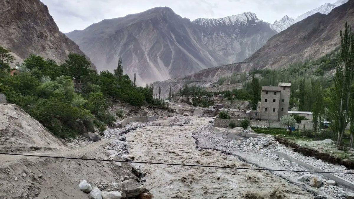
The Mendenhall River, a vital artery running along the west side of Juneau, entered major flood stage, Level 4 of 4, early Wednesday, surpassing 14 feet. Forecasts anticipate the river to crest at approximately 16.6 feet late Wednesday morning, a level that would dramatically eclipse the previous record set just last August. The rising waters have also pulled in large trees, compounding the hazardous conditions.
Andrew Park, a meteorologist with the National Weather Service in Juneau, issued a stern advisory, stating, “It’s very dangerous right now. Stay away if you can,” and urged mariners to “keep your eyes peeled for big trees.” Waters surged rapidly after the glacial outburst commenced late Tuesday morning, leading to significant flooding in Mendenhall Lake that evening, with reports of over three feet of water accumulating in certain areas.
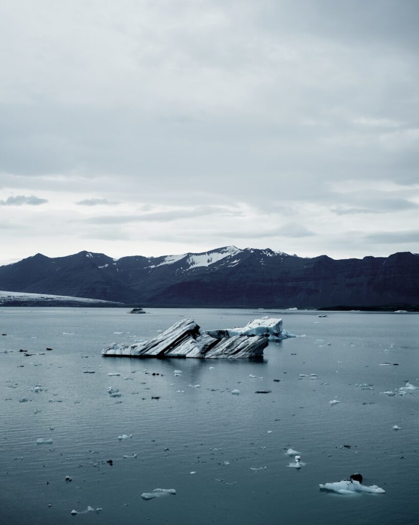
To understand the gravity of the current situation, it’s crucial to grasp what a glacial lake outburst flood (GLOF) entails. The city of Juneau vividly describes these events as occurring when a lake of melting snow, ice, and rain “drains rapidly—like pulling out the plug in a full bathtub.” This happens after the water has pooled to such a high level that it overtops the glacier that acts as its natural dam.
In this specific instance, the culprit is the Mendenhall Glacier and its companion, Suicide Basin. These geological formations abut the western portion of Juneau, positioned roughly 10 miles from the city’s bustling center. The water from the basin, estimated in billions of gallons, ultimately finds its way into the Mendenhall River and Mendenhall Lake, creating the downstream flood risk.
The mechanics behind this release are intricate. As described by KTOO’s Alix Soliman, it begins with an “over-topping” where a small amount of water spills, much like a full cup overflowing slightly. However, the true dramatic release, known as a subglacial release, happens when the immense volume of water in Suicide Basin bores a hole under the glacier, finally breaking through to the bottom, allowing for a rapid rise in the lake.
The USGS explains that glacial lakes form in small side valleys where ice has receded, subsequently becoming dammed by the main valley glacier or by rocks and debris. As these ice-free basins gradually fill with water, they eventually reach a critical “breaking point.” At this juncture, the immense water pressure opens a drain underneath the glacier, leading to a swift release of water downstream, which precipitates the GLOF.
These events, while naturally occurring, are inherently “unpredictable and have caused significant loss of life and infrastructure worldwide,” according to the USGS. The critical question of how these lake hazards might evolve as global temperatures climb and glaciers continue their retreat remains a paramount concern for scientists and communities alike.
Juneau has become intimately familiar with this cycle, as glacial lake outbursts have become a regular, and increasingly severe, occurrence since 2011. The phenomenon has worsened considerably each year since 2023, turning what was once an infrequent natural event into an annual summer threat that residents now brace for.
Last year’s glacial outburst, for instance, propelled the Mendenhall River to a crest of 15.99 feet. This unleashed destructive flooding across Juneau, impacting more than 100 homes, and was characterized by city officials as “unprecedented” in its severity. The river level recorded in 2024 has already surpassed that of 2023’s early August glacial flood by a full foot, underscoring the escalating risk.
The public is reminded of the stark visual evidence from previous years. Video footage from two years ago captured towering trees behind a home crumbling into the surging Mendenhall River as the water aggressively eroded the bank. Eventually, the very home, precariously teetering at the river’s edge, also succumbed and collapsed into the powerful current.
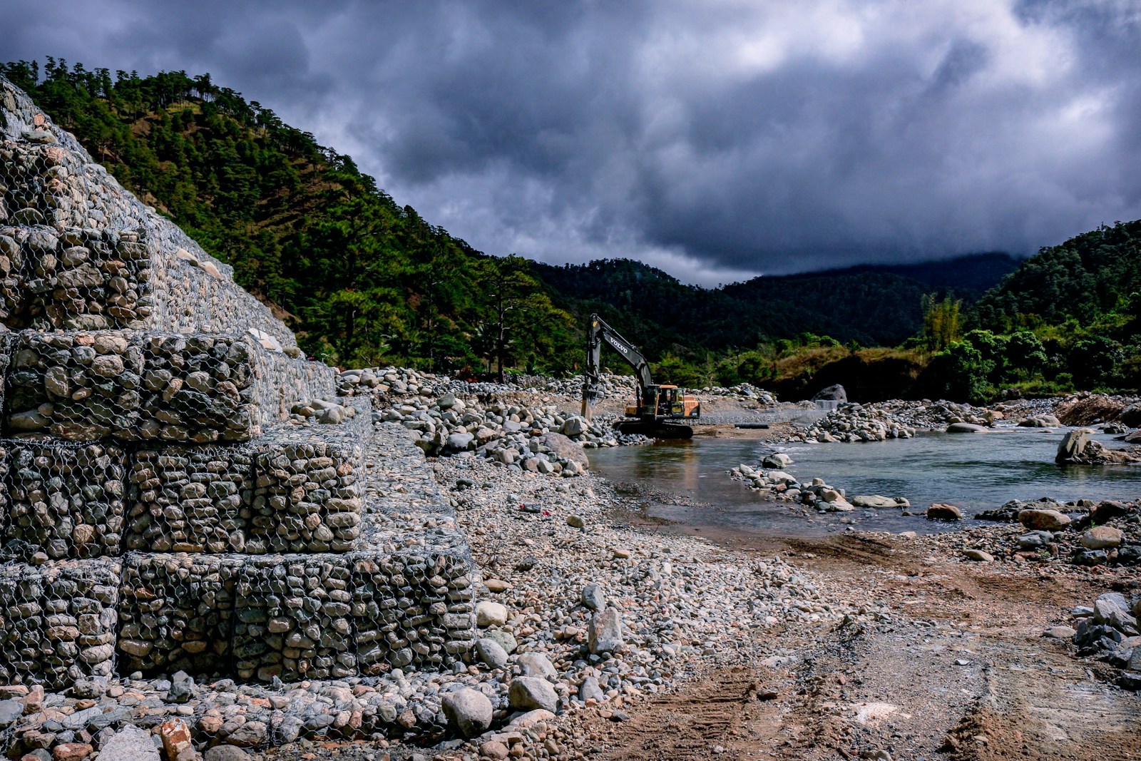
Recognizing the escalating threat, Juneau officials, with federal assistance, have taken proactive steps to mitigate potential damage. A flood barrier system, installed along the area most susceptible to inundation in 2024, now stands as a primary defense. This temporary levee, as it’s often referred to, is constructed of HESCO barriers—steel baskets filled with sand and stacked along the river in residents’ backyards.
These HESCO barriers are strategically designed to harden the riverbanks and prevent water from flowing into homes. Their intended function is to redirect the surging water to the west side of the river, an area that is predominantly uninhabited forest land. Officials have expressed confidence, based on engineering analyses, that these barriers will hold effectively at a 17-foot flood level and below, which aligns with the current predictions.
However, officials maintain a cautious stance, especially since this marks the first true test run for these newly installed barriers. They are quick to advise that anything higher than a 17-foot flood, such as an 18-foot event, could potentially see water flowing around the barriers, and their performance in a 20-foot flood remains uncertain. Thus, while confident, the message to residents is clear: “they don’t want folks to test the barriers with their lives.”
Beyond the temporary barriers, Juneau has also fortified its riverbanks with large boulders, a technique known as riprap. This measure aims to counteract the severe erosion witnessed in past flood events, which led to homes being undercut and lost to the river. While the water level in the river could still be exceptionally high, the riprap is expected to significantly reduce bank erosion.
In preparation for the impending crest, emergency managers are urging many residents of Alaska’s capital city to evacuate. Although no mandatory evacuations are currently in place for all of the roughly 1,000 residents and businesses in the inundation zone, officials are emphatically advising everyone in the area to leave before river levels peak, emphasizing that “This is likely to become a life-threatening situation.”
Senator Lisa Murkowski, a Republican, underscored the gravity in an X post, stating, “If you are told to evacuate, stop what you are doing and immediately go to an emergency shelter or another safe location.” A Red Cross shelter has been established at Floyd Dryden Gymnasium to provide refuge for those needing to evacuate.
Alaska Governor Mike Dunleavy demonstrated foresight by issuing a preemptive disaster declaration on Sunday. This crucial step aims to “better streamline emergency response efforts to the outburst,” allowing the state to “position state resources and personnel in advance to support local and tribal governments in their efforts to protect lives, homes, and essential services.” The governor’s stated goal is to “act early to reduce impacts and preserve community safety.”
Several facilities along the Mendenhall River, including the Mendenhall Valley Public Library, Diamond Park Field House, Diamond Park Aquatic Center, and all nearby fields, were proactively closed on Tuesday due to the hazardous conditions. Roads, such as Mendenhall Loop Road (Back Loop Bridge), have also been closed and will remain so until water levels recede below 12 feet and bridge engineers complete safety inspections.
The Federal Aviation Administration (FAA) has also imposed a temporary flight restriction (TFR) around the area. This TFR, as explained by the Alaska Department of Transportation & Public Facilities, “creates controlled airspace to ensure safe aerial operations for geo-hazard monitoring, flood response, and potential evacuations,” highlighting the multi-faceted nature of the emergency response.
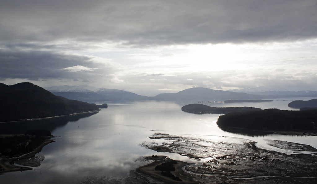
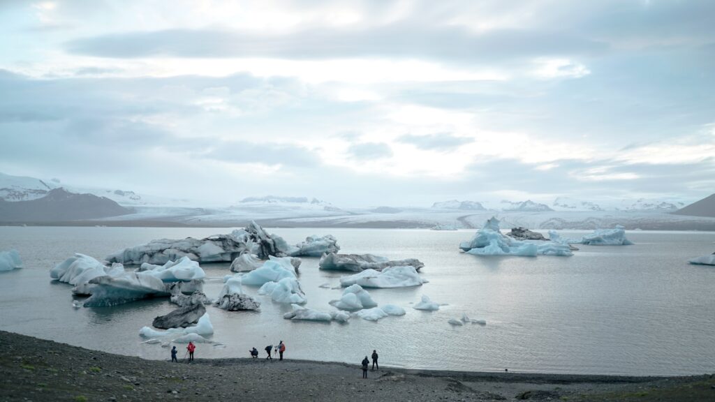
Juneau, the capital of Alaska, is home to approximately 33,000 residents, according to the U.S. Census Bureau. The city is geographically distinct, surrounded by coastal waters to its west and south, while the Mendenhall Glacier, a popular tourist attraction, lies about 12 miles from the city center, easily accessible via walking trails. Homes on the city’s outskirts are within miles of Mendenhall Lake, which lies below the glacier, with many fronting the Mendenhall River.
The fundamental question, “Why does this keep happening?” leads directly to the broader implications of climate change. These increasingly frequent and severe glacial lake outbursts are yet another stark “consequence of climate change due to fossil fuel pollution.” The Arctic, encompassing Alaska, is experiencing warming at a rate twice as fast as the rest of the planet as global temperatures continue their relentless rise.
This accelerated warming is causing glaciers, including the Mendenhall, to thin or melt entirely. A significant transformation has occurred in the Suicide Basin: a portion of its once icy expanse has now been replaced by an earthen divot. This divot, like a collecting vessel, fills up like a bathtub each summer, initiating the sequence of events that leads to the annual flood. As the ice melts back, the basin actually grows, creating more room for water and, consequently, allowing for the release of “bigger floods.”
The National Centers for Environmental Information note that Alaska has warmed twice as fast as the rest of the country over the last several decades, with its average annual temperature increasing by 3.1 degrees Fahrenheit in the past century. This data provides crucial context for the observed changes in glacier behavior and the increased flood risk.
Despite the significant threat, there’s a unique blend of caution and routine visible among Juneau’s residents. Alix Soliman observed during an interview that while some residents are deeply worried, particularly those without the protection of new barriers, others who have built their own berms are planning to stay. She recounted seeing “kids riding their bikes and people walking their dogs,” even as the flood waters rose, a testament to the community’s resilience and daily rhythms continuing amidst the looming threat.
For those seeking the most current information, resources like KTOO.org offer live coverage, prerecorded videos with experts and emergency managers, and even a new podcast titled “Outburst.” This podcast delves into how the floods have evolved over time, the science underpinning the phenomenon, and the ways in which people are preparing for and adapting to these recurring challenges.
As Juneau faces yet another record-setting glacial outburst, the situation serves as a powerful reminder of the profound and immediate impacts of climate change on communities. The careful balance between natural forces and human ingenuity, between the relentless melt of ancient ice and the adaptive spirit of a resilient population, continues to define life in Alaska’s capital. The question is not just whether the waters will recede, but how Juneau will continue to navigate a future shaped by a rapidly changing climate, adapting and innovating to protect its people and its unique place in the world.


")