


The Atlantic basin is stirring, with forecasters announcing the formation of Tropical Storm Erin in the eastern Atlantic Ocean on Monday. This new system is quickly gaining attention as it is expected to strengthen significantly, potentially becoming the first hurricane of the 2025 Atlantic season and even escalating into a major hurricane later in the week.
Erin formed just west of the Cabo Verde islands, an archipelago situated off the western coast of Africa. The U.S. National Hurricane Center in Miami has indicated that the storm is on a westward trajectory, a path that will take it into a region known for fostering robust tropical systems.
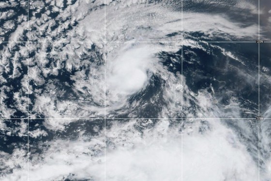
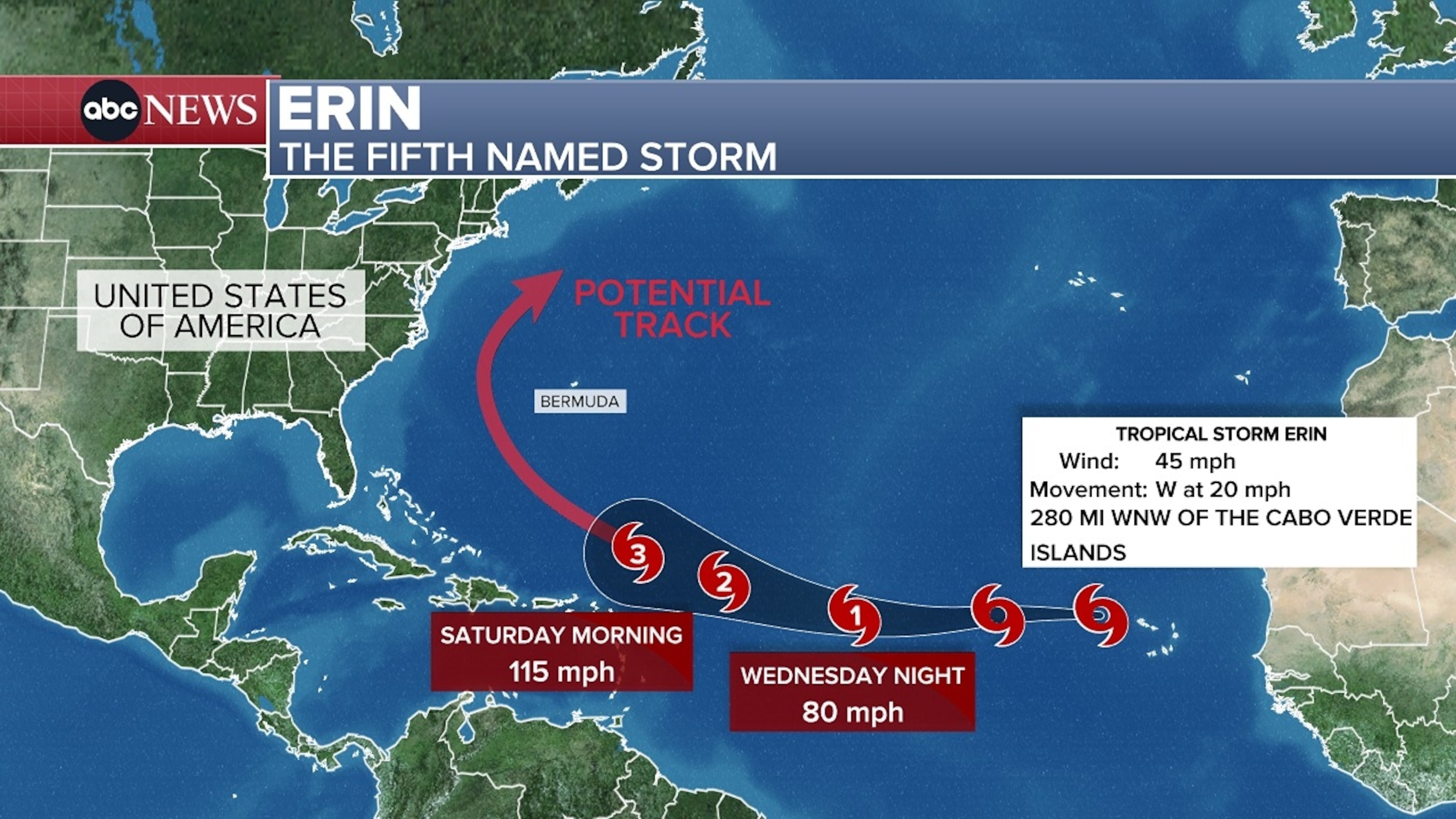
As of late Monday afternoon, the center of Tropical Storm Erin was located approximately 2,155 miles east of the northern Leeward Islands in the West Indies. At this point, the storm was generating maximum sustained winds of 45 mph, a speed that classifies it as a tropical storm. By 11 a.m. on Monday, August 11, the storm was moving west at 20 mph and was located 280 miles west-northwest of the Cabo Verde Islands and over 2,300 miles from the Leeward Islands.
Early projections from various models indicate a concerning outlook for Erin’s development. Forecasters anticipate the storm will intensify into a major hurricane as it approaches the Caribbean islands toward the end of the current week. This rapid strengthening is a key concern for meteorologists and coastal communities.

Before its official designation as Tropical Storm Erin, the system, then known as Invest 97L, delivered a severe impact on the Cabo Verde islands. Torrential rain and thunderstorms led to extensive flooding across the group of islands, which lie about 385 miles off the African coast. This devastating pre-storm activity resulted in tragic loss of life.
Local officials in Cabo Verde reported that at least seven people, including children, were killed due to the storm’s initial effects. The Ministry of Education expressed profound sorrow, stating, “The Ministry of Education expresses its deepest sorrow for the tragic loss of seven lives, including four children, on the island of São Vincent.” This heartbreaking toll prompted government officials to declare two days of national mourning, acknowledging both the human lives lost and the significant material damage inflicted by the system.

Even as a tropical rainstorm, the system dumped an estimated 7 to 8 inches of rain on the Cabo Verde Islands. Emergency crews are actively dealing with the widespread damage, highlighting the destructive potential of these systems even before they reach hurricane strength. The state of emergency underscores the severe conditions experienced in the region.
Tropical Storm Erin is positioned to move through what meteorologists refer to as the “main development region” of the Atlantic. This expansive stretch extends from Africa’s west coast all the way to the Caribbean, acting as a fertile ground where many tropical systems begin to coalesce and gain strength, especially as the hurricane season enters its typically busiest period.
One of the primary drivers for Erin’s anticipated intensification is the exceptionally warm ocean water in this development region. Sea surface temperatures are currently much warmer than normal, providing ample “fuel” for the storm to tap into as it progresses westward. While these temperatures are not quite at the record levels observed in 2023 and 2024, they remain significantly elevated, contributing to favorable conditions for tropical cyclone development.
AccuWeather’s lead hurricane expert, Alex DaSilva, highlighted this critical factor in an online outlook. DaSilva noted that water temperatures across much of the Atlantic “are plenty warm to support tropical development and even rapid intensification.” This abundance of warm water could enable Erin to undergo rapid intensification, potentially becoming the season’s first major hurricane, defined as Category 3 or higher, as early as Saturday.

Despite the clear trajectory of initial strengthening, there remains considerable uncertainty regarding Erin’s long-term path beyond this week. Most models currently suggest the storm will pivot towards the northwest and then north. This forecast, however, is subject to change based on various atmospheric factors that could influence Erin’s steering.
Shane Hinton, a CBS News Miami meteorologist, emphasized this uncertainty, noting that the storm’s ultimate destination will largely depend on its strength and the position of the Bermuda high. This large area of high pressure over the Atlantic Ocean acts as a crucial steering mechanism for tropical systems, dictating whether they continue westward or curve northward away from land.

Another significant factor is the strength and speed of a cold front moving off the eastern coast of the United States. According to DaSilva, a fast and strong cold front could potentially push Erin back out to sea, away from the U.S. East Coast. Conversely, a slow and weak cold front might allow the storm to push right through, posing a direct threat to the Eastern Seaboard. Other variables such as wind shear also play a role in shaping the storm’s trajectory.
It is crucial to remember that forecast tracks, often depicted on “spaghetti models,” represent the most likely path of the storm’s center. These models do not illustrate the full width or potential impacts of the storm. The center of a storm can travel outside the cone up to 33% of the time, reinforcing the need for continuous monitoring and preparedness across a wider area than just the immediate forecast cone.


