

Have you ever paused to wonder why some of America’s most bustling metropolises are exactly where they are? It’s a question that has long captivated urban planners, historians, and anyone with a curious mind. From glittering skylines to sprawling suburbs, each city tells a unique story, often rooted in a fascinating blend of geography, historical foresight, and sheer human ingenuity.
Indeed, these aren’t just random dots on a map; they are the result of powerful forces, both natural and man-made, converging in just the right places. Understanding these ‘whys’ gives us incredible insight into the very fabric of our nation, revealing the patterns and principles that have guided urban development for centuries. It’s truly a puzzle with thousands of pieces, and today, we’re going to piece together some of the most compelling answers.
Join us on an exhilarating journey across the continental United States as we uncover the surprising and often brilliant reasons behind the locations of some of our most significant cities. Get ready to have your perceptions of urban landscapes delightfully reshaped, as we kick off the first half of our exploration into America’s urban blueprint, revealing how foundational advantages set the stage for these mighty centers.
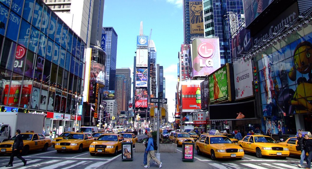
1. **New York: The Gateway to the Atlantic via Inland Waterways**It’s almost impossible to imagine America without New York City, a global titan of commerce and culture. But its rise to prominence wasn’t just happenstance; it was a masterstroke of geographical positioning. The city emerged as the crucial connection between the vast Great Lakes area and the bustling Atlantic Seaboard, all thanks to a remarkable engineering feat: the Erie Canal, built in the 19th century.
This incredible canal, combined with the natural arteries of the Hudson and Mohawk Rivers, provided the best possible route to cut through the formidable Appalachian Mountains. These waterways conveniently reached the coast right at New York, giving it an unparalleled advantage. Suddenly, a vast inland territory had direct access to the ocean, and New York was the natural point of transfer.
Manhattan itself is perfectly placed, nestled upstream of the Hudson River, which offered natural protection from the raw power of the open sea. This sheltered location meant that ships could dock safely, facilitating transatlantic trade and making New York the major port for goods flowing in and out of the continent. It became an undisputed economic powerhouse.
Because it was the original trade port, New York quickly became the focal point for subsequent transportation networks. Railways converged here, reinforcing its position as a trade hub, which then naturally justified the construction of major roads and highways, and eventually, one of the world’s most extensive airport systems. This is the power of network effects in action, amplifying its initial advantages exponentially.
The sheer scale of its early infrastructure, driven by its prime location, created a self-reinforcing cycle of growth. New York’s story is a prime example of how strategic geographic features, when leveraged by human innovation, can transform a coastal settlement into a global metropolis, truly defining a nation’s economic landscape.
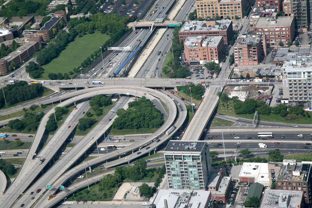
2. **Chicago: The Crossroads of America’s Inland Empires**Moving westward, we find Chicago, another monumental urban center whose location is a testament to the power of inland trade. Much like New York, Chicago didn’t just appear out of nowhere; it became the vital trade hub between two colossal natural systems: the mighty Mississippi River Basin and the expansive Great Lakes. Think of it as the central nervous system connecting the agricultural heartland to the industrial north.
This unique intermediary position allowed Chicago to become a lynchpin in the nation’s transportation network. It was the place where goods from the vast river systems of the Midwest could seamlessly transfer to the Great Lakes and vice versa, opening up immense economic opportunities. This wasn’t merely a convenient spot; it was strategically essential.
As trade flourished, Chicago solidified its role as a monumental hub. It rapidly developed into a pivotal center for railroads, with lines fanning out in every direction, cementing its status as the nation’s railway capital. This was followed by an intricate network of highways and, predictably, a major international airport, all built upon its original geographical advantage.
The city’s strategic location meant that it could efficiently distribute resources and products across a vast region, fostering industrial growth and attracting a diverse population. It truly became the ‘Second City’ not just in size, but in its ability to mirror and complement New York’s role as a continental gateway, albeit an inland one.
So, while New York connected the nation to the world, Chicago connected the nation to itself. Its enduring legacy as a major transportation and commercial hub speaks volumes about the incredible power of being in the right place at the right time – and then building the infrastructure to make it even more right.
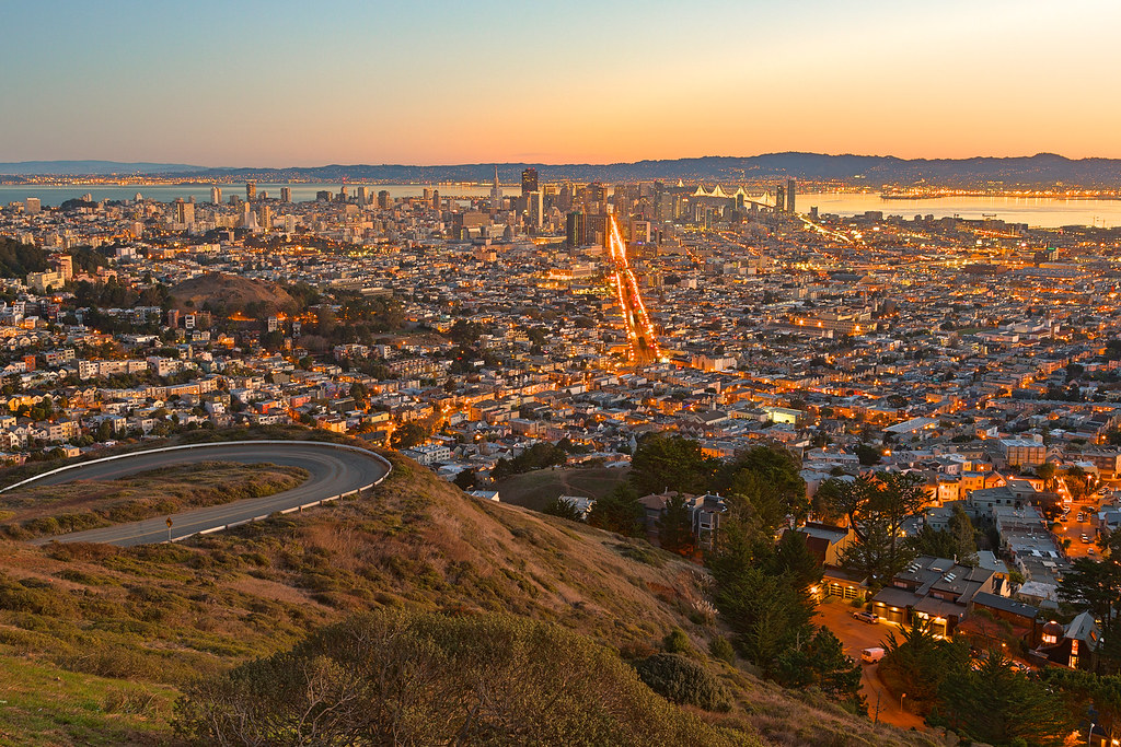
3. **San Francisco: Golden Gate to the Pacific, Sustained by a River**Crossing to the West Coast, San Francisco immediately captures the imagination with its iconic bay and stunning vistas. Its location, much like its gold rush history, is rooted in a specific, brilliant geographical advantage: it served as the critical trade hub between California’s incredibly fertile Central Valley and the vast Pacific world beyond. It’s a classic tale of port meets hinterland.
The secret ingredient? San Francisco Bay boasts a magnificent deep-water port, a natural marvel that allowed large vessels to easily access and anchor. This deep water access was, and still is, invaluable for international shipping, making it an ideal nexus for global commerce. But there’s another crucial piece to this puzzle that truly makes it special.
The San Francisco Bay is also the estuary of the Sacramento River. This mighty river, in turn, drains and serves the entire northern Central Valley, including the agriculturally rich Sacramento area and, historically, the legendary Gold Rush regions. This river system provided an inland highway, bringing agricultural products, timber, and mining riches directly to the doorstep of the deep-water port.
Thus, San Francisco wasn’t just a pretty face on the coast; it was the essential funnel through which the riches of California’s interior flowed to the rest of the world. This synergy between a superb natural harbor and an extensive navigable river system created an economic powerhouse that quickly overshadowed other coastal settlements.
Even today, this unique combination of a deep-water port and river access ensures San Francisco’s continued importance as a trade and logistics center. It’s a testament to how the convergence of water, land, and economic opportunity can forge a city that truly stands the test of time, blending natural beauty with profound utility.
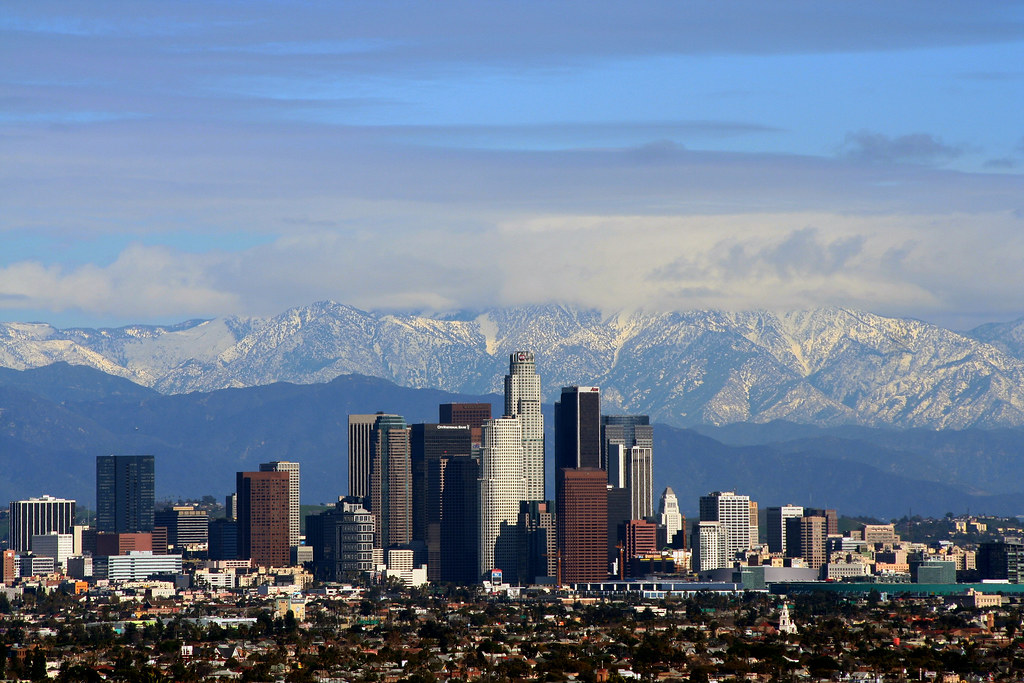
4. **Los Angeles: From Agricultural Abundance to a Global Metropolis**Los Angeles, the sprawling Southern California behemoth, offers a slightly different origin story compared to its northern cousin, San Francisco, or the eastern trade giants. Interestingly, LA didn’t begin its journey as a natural trade hub. It lacked a deep-water port and a large navigable river to connect with its immediate hinterland, which are typically prerequisites for major port cities. So, what was its secret?
The answer lies in its vast, flat plain, an expansive agricultural paradise on a coast that is otherwise strikingly mountainous. This fertile plain was ideal for farming, providing a solid economic base from the outset. This agricultural bounty was enough to attract attention and, crucially, to warrant connection to the burgeoning railway networks.
First, LA was linked to San Francisco via railway, establishing a crucial northern connection. Later, the Santa Fe railway extended its reach, connecting Los Angeles to the rest of the United States. This rail access transformed it into the undisputed Southern California trade hub, allowing its agricultural products to reach distant markets and goods to flow in. From that point, its growth truly accelerated.
As if excellent agriculture and crucial rail links weren’t enough, Los Angeles then struck oil, adding another layer to its economic foundation. But perhaps even more famously, its good weather, incredibly diverse surrounding landscapes (from beaches to mountains), and its geographic distance from the established East Coast centers of power proved irresistible to a nascent industry: movies. Hollywood became a global phenomenon, further cementing LA’s unique identity.
During World War II, its strategic location on the Pacific rim transformed it into an important military port, a role it has adeptly maintained, along with significant heavy industries. While the region is notoriously dry, leading to complex regional water sourcing solutions, LA’s ability to pivot and capitalize on diverse advantages—agriculture, rail, oil, entertainment, and defense—is a remarkable example of urban evolution, proving that sometimes, you make your own luck.

5. **Seattle: The Rainy Haven of the Pacific Northwest**While Los Angeles and San Diego famously grapple with aridity, the Pacific Northwest paints a strikingly different picture. Here, in the verdant expanse of Washington and Oregon, we find Seattle and Portland, cities blessed with an abundance of rain—the most in the entire US, in fact. This isn’t just a quirky weather pattern; it’s a foundational element of their existence.
The generous moisture comes from strong Pacific winds that, at Seattle’s latitude, bring a torrent of water onto the land. However, the urban centers aren’t directly on the most exposed coastline. If you look closely at rainfall maps, you’ll notice two parallel bands of rain in the west of Washington and Oregon, with a reasonably drier, much warmer area nestled between them.
This fascinating climatic phenomenon occurs because there’s a valley situated between two coastal mountain ranges. A lower-lying range, the Coastal Range (known as the Olympic Mountains in Washington), and the taller Cascades to the east. Each range effectively catches some of the incoming rain, creating a protected, warmer, and drier microclimate in the central valley between them. This specific valley is called the Puget Sound Lowlands in Washington State, and it’s where Seattle chose to put down its roots.
Seattle, nestled within the Puget Sound Lowlands, benefits immensely from being shielded from the fiercest rains and winds of the Pacific Ocean by the Olympic Mountains. Yet, it also boasts a deep-water port within this protected sound, an ideal combination for commerce. This allowed it to efficiently trade the rich goods of its hinterland, historically timber, gold, and coal, with the wider world.
Like San Francisco and Los Angeles, Seattle’s strategic importance was magnified during World War II, when it became a crucial military port. Its unique geographical advantages—a protected, temperate valley with a deep-water port, fed by the abundant resources of the Pacific Northwest—have allowed it to flourish, transforming from a resource outpost to a vibrant tech and trade hub, a true testament to finding the perfect balance between protection and access.

6. **Phoenix: Engineering Life in the Arid Southwest**As we venture further east from the Pacific Northwest, we encounter a starkly different landscape: the semi-desert region of Arizona, home to Phoenix and its sister city, Tucson. One might wonder how such massive urban centers could thrive in such an arid environment. The answer, surprisingly, is green—and engineered.
Notice the vibrant green areas surrounding these cities? That’s the Gila River Basin. These river basins, fed by tall mountains to the north, historically provided Phoenix with the majority of its water. It’s a classic example of human settlement gravitating towards natural water sources, even in otherwise inhospitable lands. But natural flow alone wasn’t enough for a city of Phoenix’s scale.
The rest of Phoenix’s water, and a significant portion of Tucson’s, comes from the vast Colorado River Basin. This massive system effectively catches nearly all the rain from the southern Rockies, channeling it through an intricate network of rivers. However, the Colorado River itself, which once flowed all the way to the Sea of Cortez, no longer does, thanks to extensive water usage and diversion for human activities.
This is where human ingenuity truly shines. The entire river’s basin has been meticulously engineered to distribute water precisely where it’s needed. The Central Arizona Project (CAP), for instance, is an incredible testament to this, channeling vital water to Phoenix and Tucson. Without such monumental water management and diversion projects, cities of their size simply couldn’t exist in such a challenging environment.
Phoenix stands as a powerful symbol of overcoming geographical limitations through ambitious engineering and foresight. It’s a city that literally built its own water supply, transforming a sun-baked desert into a vibrant, thriving metropolitan area. This story highlights how crucial resource management is, proving that even nature’s sternest challenges can be met with innovation, turning barren landscapes into bustling hubs of human activity.

7. **Denver: Where Mountains Meet Plains, and Water Flows**Continuing our eastward journey, we reach the last major urban centers in the western half of the US: the Mile High City, Denver, along with its close companions, Boulder and Colorado Springs. Their placement is a classic example of a recurring theme in urban development: locating at the precise meeting point of a river and a mountain fall line. It’s a geographic sweet spot that offers a blend of resources and accessibility.
In Denver’s case, the lifeblood is the South Platte River, a significant tributary of the mighty Mississippi. This river is uniquely fed from the majestic Rocky Mountains, specifically at one of their tallest points, the Front Range. This high-elevation source is absolutely critical, as it allows the region to capture some of the precious moisture carried by winds from the Pacific Ocean. Imagine, Pacific moisture helping to sustain an inland city!
This crucial hydrological advantage means that Denver has access to a reliable water supply, a non-negotiable factor for urban survival, even though it’s situated deep in the middle of the country. Occasionally, these formidable mountains also capture rains originating from the Gulf of Mexico, adding another layer of natural replenishment to the city’s water reserves.
Beyond water, being on a mountain fall line often means a transition from rugged, elevated terrain to flatter plains. This transition point is ideal for settlement because it provides both the resources of the mountains (minerals, timber) and the easier terrain of the plains for construction and agriculture. It creates a natural pinch point for trade and travel.
Denver, therefore, isn’t just a city with a spectacular mountain backdrop; it’s a strategically chosen location where the powerful forces of geology and hydrology converge to support human habitation and economic activity. It’s a vibrant testament to finding prosperity at the crossroads of grand natural features, leveraging altitude and rivers to create a thriving urban core in an otherwise demanding landscape.
Having journeyed through the foundational geographic advantages that shaped America’s first set of urban titans, it’s time to pull back the curtain on another fascinating collection of cities. As we venture further, we’ll discover how strategic confluences, specialized economies, and even unique climatic conditions continued to carve out the diverse urban tapestry of the United States. Get ready to have your mind tickled with more surprising insights into the ‘whys’ of our world!
We’ll uncover cities that defied the traditional coastal paradigm, ones built on the very idea of connection, and others that specialized their way to greatness. Each story is a vibrant testament to human adaptability and ingenuity, demonstrating that sometimes, the most unexpected locations hold the keys to flourishing urban centers. So, let’s dive into the next chapter of our epic urban quest, exploring seven more iconic US cities and the ingenious reasons behind their locations.
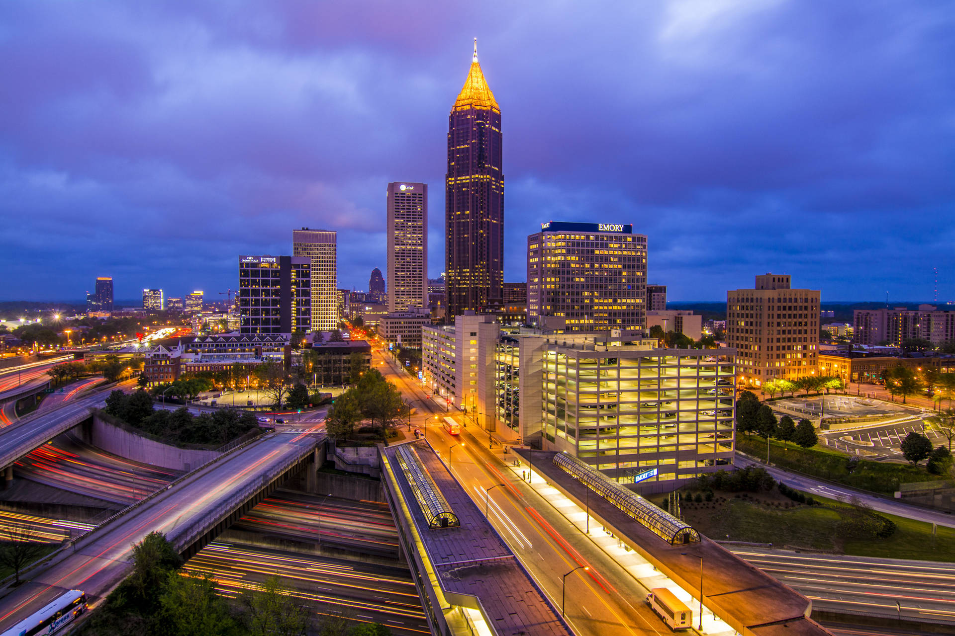
8. **Atlanta: The Inland Trade Labyrinth**Unlike its coastal cousins, New York and San Francisco, Atlanta didn’t get a head start from a natural deep-water port or a major navigable river. So, how did this bustling metropolis in Georgia rise to such prominence? Its story is a fascinating testament to human-engineered connections, making it a pure railway, and later highway and airport, trade hub that defied traditional geography.
Atlanta emerged as the vital intermediary between the expansive Mississippi Basin and the Atlantic Coast, cleverly positioned south of the formidable Appalachian Mountains. In an era when major southern cities like Nashville, Chattanooga, Macon, Augusta, and Savannah dominated, Atlanta was literally the ideal sweet spot to link them all together. It was nestled strategically between these established centers, a veritable crossroads waiting to happen.
Its location just south of the Appalachians was crucial, offering an accessible corridor for transportation networks to develop. Furthermore, its proximity to the Chattahoochee River ensured a reliable water supply, an absolute necessity for any growing settlement. Being on the river’s eastern bank simplified bridge construction, making it easier to connect to cities like Macon and Augusta on one side, and Chattanooga on the other. This combination of factors made Atlanta a magnet for infrastructure development.
Indeed, Atlanta’s growth wasn’t just organic; it was meticulously planned and executed. The railways converged here, transforming a modest settlement into a powerhouse of logistics and distribution. This initial advantage then cascaded into a self-reinforcing cycle of development, attracting more industries, people, and further infrastructure, proving that sometimes, you don’t need a natural port when you can build the ultimate inland connection.
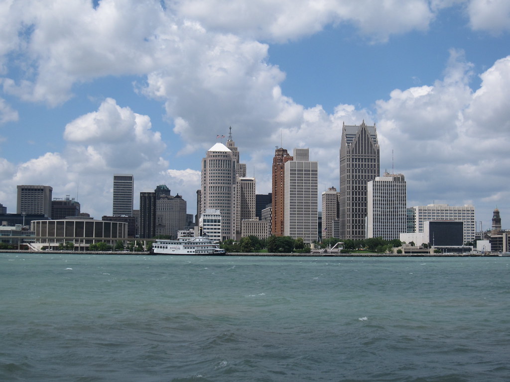
9. **Detroit: The Strait that Forged an Industrial Giant**Journeying north to the Great Lakes, we encounter Detroit, a city whose very name, meaning “strait” in French, hints at its geographical destiny. Its location as a trade hub between Lakes Huron and Erie, and the vast lands surrounding them, set the stage for an industrial saga that would redefine American manufacturing.
In its nascent years, Detroit was a hub for incredibly lucrative trades in furs and timber. The seamless movement of these valuable resources across the Great Lakes system was central to its early economic vitality. This constant flow of goods necessitated robust transportation solutions, leading naturally to the development of a thriving shipbuilding industry right on its shores.
The expertise, infrastructure, and supply chains cultivated by shipbuilding proved to be an invaluable foundation. The ironworks, machine shops, and foundries required to construct vessels simultaneously developed a highly skilled local labor force and robust supply chains. This laid the groundwork for future industrial diversification, creating an environment ripe for innovation and production.
As the industrial revolution gained momentum, these refined skills and established supply chains were deftly repurposed. What started with ships soon expanded to the manufacturing of stoves, then railcars, and agricultural equipment. This progressive evolution of industrial capability ultimately culminated in the advent of the automobile, transforming Detroit into the undisputed heartland of the American car industry and a symbol of industrial might.
10. **Portland: The Columbia River’s Verdant Gateway**While its Pacific Northwest sibling, Seattle, leveraged a protected coastal sound, Portland carved out its destiny at a truly impressive hydrological nexus. Nestled at the confluence of the mighty Willamette and Columbia Rivers, Portland became the quintessential gateway between the expansive Columbia River Basin and the wider world, a prime example of strategic confluence at work.
This unique riverine position allowed Portland to serve as the critical point where goods from the vast interior could be transferred to ocean-going vessels and vice versa. The Columbia River itself is a phenomenal inland highway, navigable by ocean freighters as far upriver as Portland and Vancouver (its Washington State counterpart), and by barges reaching as far inland as Lewiston, Idaho.
Such extensive navigability turned Portland into an invaluable hub for transporting agricultural products, timber, and other resources from the rich Columbia River Basin to global markets. The city’s growth was inextricably linked to the flow of this powerful river system, harnessing its natural advantage to foster robust trade and economic development.
Moreover, the same strong Pacific winds that bring abundant moisture to the Pacific Northwest ensure a verdant landscape, supporting the region’s productive agriculture and timber industries. This combination of natural resources and a unparalleled riverine transportation network cemented Portland’s role as a vital economic center, a testament to the power of harnessing major river systems for sustained urban prosperity.
11. **Albuquerque: The Rio Grande’s Rail and Road Crossing**Moving southeast from Denver into the drier landscapes of New Mexico, we find Albuquerque, a city whose origins are intimately tied to a crucial river crossing. Although situated in an arid region, the city thrives thanks to the life-giving waters of the Rio Grande valley, a lifeline that shaped its very existence.
Rivers, by their nature, demand crossings, and Albuquerque emerged precisely because it offered an ideal location for an early east-west railroad to traverse the Rio Grande. This strategic crossing point made it an indispensable link in the burgeoning national transportation network, drawing people and commerce to its nascent settlement.
From this initial rail advantage, Albuquerque’s centrality in New Mexico only grew. As the default choice for river crossings, it became a natural focal point for subsequent infrastructure development. Famously, the legendary Route 66 was built through Albuquerque, further amplifying its role as a key transit hub for travelers and goods moving across the Southwest.
Thus, Albuquerque stands as a prime example of a city born from the strategic necessity of overcoming natural barriers. Its location on the Rio Grande, coupled with its role as a critical railroad and highway crossing, transformed a dry valley into a bustling urban center, illustrating how transportation infrastructure can catalyze growth even in challenging environments.
12. **El Paso / Ciudad Juárez: A Border Story of Two Cities**Further south, straddling the US-Mexico border, lie the twin cities of El Paso and its larger Mexican counterpart, Ciudad Juárez. Their existence isn’t primarily dictated by vast rivers or resource-rich plains in the traditional sense, but by a unique economic phenomenon: border arbitrage.
These cities are strategically located at the westernmost point on the US-Mexico border that is defined by the Rio Grande. This specific geographic feature established a clear, albeit politically defined, division that became a magnet for human activity and economic exchange. The very presence of the border created distinct economic opportunities.
Border arbitrage, the act of profiting from differing prices or regulations across a border, became the foundational motive for their growth. The dynamic interplay of economies, labor markets, and legal frameworks on either side of the Rio Grande generated a vibrant cross-border ecosystem, drawing populations and businesses seeking to leverage these unique conditions.
Therefore, El Paso and Ciudad Juárez are powerful illustrations of how political geography, coupled with a natural boundary like the Rio Grande, can create a specialized economy. Their story is less about innate natural resources and more about the human-made construct of a border, demonstrating its profound influence on urban formation and economic specialization.
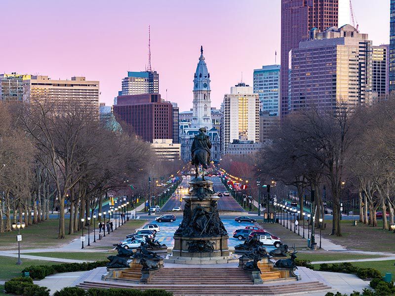
13. **Philadelphia: The Northeastern Fall Line Marvel**Moving to the densely populated Northeastern US, cities like Philadelphia, Boston, Baltimore, and Washington D.C. share a common, powerful geographic secret. They all emerged at the quintessential “crossroads between fall lines and rivers coming from the same mountains,” a perfect storm of accessibility and resource availability that fueled their monumental growth.
In this region, the Appalachian Mountains impressively hug the Atlantic coast, creating a unique geological scenario. The “fall line” marks the transition point where the rugged, elevated terrain of the mountains gives way to flatter coastal plains. This area is a natural sweet spot for settlement because it offers the first easily buildable flat land for roads and infrastructure.
Crucially, these cities are also typically situated on navigable rivers that originate from these same mountains, effectively making them the “heads of navigation.” This allowed for seamless trade between the vast hinterlands, rich with resources, and the boundless opportunities of the Atlantic Ocean. Goods could be transported downriver and then loaded onto ocean-going vessels, making these cities indispensable trade gateways.
Philadelphia perfectly embodies this pattern: it’s on the Atlantic Coast, protected from the open ocean, possesses a deep-water port, and lies directly on the fall line where the Appalachians meet the plain. This unparalleled combination of protection, navigability, and accessible terrain transformed it into a bustling metropolis, cementing its role as a vital hub for commerce and culture in the early days of the nation and beyond.

14. **Minneapolis – St. Paul: The Mississippi’s Head of Navigation**Finally, we journey to the heartland, to the vibrant twin cities of Minneapolis and St. Paul, located at an incredibly strategic point: the confluence of the mighty Mississippi and Minnesota Rivers. This isn’t just a picturesque meeting of waterways; it’s a geographic phenomenon that established them as the undisputed “head of navigation” for the entire Mississippi River system.
The combined waters of the Mississippi and Minnesota Rivers at this juncture create a navigable waterway that extends all the way down to the Gulf of Mexico in New Orleans. This unique capability meant that Minneapolis-St. Paul became the furthest upstream point accessible by significant waterborne commerce, making it a natural bottleneck and distribution point.
This pivotal position transformed the twin cities into the ultimate trade hub for all the vast hinterland stretching north and west of this point. Agricultural products, timber, and other resources from the sprawling Upper Midwest could be efficiently gathered here and then transported downriver, connecting the heart of the continent to the global economy.
The “head of navigation” status, combined with the power generated by the Falls of St. Anthony, spurred industrial development, particularly in milling and lumber. Minneapolis and St. Paul are truly a testament to the incredible leverage offered by controlling a critical juncture in a major river system, illustrating how natural flow lines dictate patterns of trade and settlement across continents.
And there you have it! From coast to plains, mountains to rivers, we’ve pieced together the incredible stories behind why 14 of America’s major cities are exactly where they are. It’s a testament to how geography, human ingenuity, and the relentless pursuit of connection have shaped our urban landscapes, turning natural features into thriving centers of civilization. Each city, a fascinating chapter in the grand narrative of America’s development, stands as a reminder that every place has a story, etched into its very foundations.


