On Monday, August 25, 2025, the city of Phoenix, Arizona, was enveloped by a colossal dust storm, a meteorological phenomenon known as a haboob, which dramatically plunged the urban landscape into an unsettling darkness. This immense wall of dust, towering hundreds of feet high, swept across the metro area, altering the skyline in a matter of moments and preceding a series of severe thunderstorms that further intensified the chaos.
This event marked a significant disruption for thousands of residents and critical infrastructure, leaving a trail of downed trees, extensive wind damage, and widespread power outages in its wake. The immediate aftermath saw a city grappling with diminished visibility, grounded flights, and a sudden, visceral experience of nature’s formidable power, highlighting the desert environment’s unique challenges.
The ensuing analysis delves into the specifics of this remarkable weather event, detailing its progression, the profound impact on daily life and essential services, and the crucial advisories issued by authorities. Through a comprehensive examination, this report seeks to illuminate the multifaceted consequences of the haboob and subsequent storms, underscoring the resilience of the community and the importance of preparedness in the face of such natural spectacles.
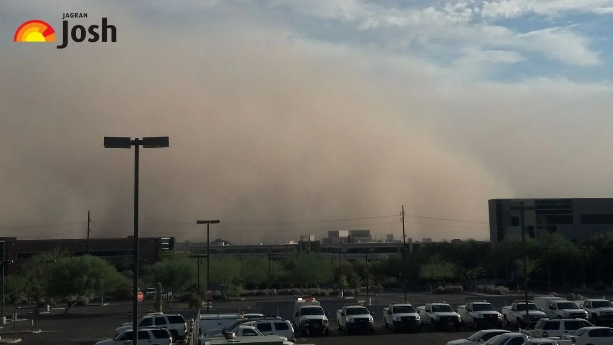
1. **The Haboob’s Arrival: Phoenix Plunges into Darkness**A massive dust storm, meteorologically termed a haboob, consumed Phoenix on Monday, August 25, 2025, transforming the bustling city into an apocalyptic-like scene as it engulfed homes and surrounding areas. This gigantic wall of dust, which video footage depicted consuming the city, dramatically reduced visibility to near-zero and plunged the area into darkness, marking a profound and sudden shift in the daily environment.
The National Weather Service in Phoenix issued a dust storm and severe thunderstorm warning around 7:10 p.m. local time on August 25, as the system pushed into Maricopa County. The haboob, which began its advance from the southeast, was observed blowing across San Tan Valley just before 5 p.m. and reached downtown Phoenix within an hour, demonstrating its rapid progression across the landscape.
Described as a rolling wall that can climb thousands of feet high and stretch for miles, the haboob cut off the horizon in seconds, akin to a blizzard in winter. The sheer density of the dust was so profound that it choked out light, making it nearly impossible to see more than a few feet in front of oneself in the storm’s worst moments. This sudden obscuring of the environment underscored the unique and powerful nature of the phenomenon, leaving a lasting impression on those who witnessed it.
2. **The Aftermath of Wind and Rain: Storms Follow Dust**The towering wall of dust that swallowed parts of metro Phoenix was quickly followed by severe thunderstorms that tore through the city, amplifying the impact of the initial haboob. These storms brought with them considerable wind damage and contributed significantly to the widespread disruption experienced across the region, further compounding the challenges faced by residents and emergency services.
Wind gusts were particularly destructive, with speeds reaching 70 mph at Phoenix Sky Harbor International Airport. Other reports indicated gusts of 60 mph at the airport and up to 66 mph near East Mesa, demonstrating the storm’s formidable power. These intense winds were responsible for shredding a connector bridge at the airport and tearing a roof off a home near Marana, Arizona, showcasing the physical force unleashed by the weather event.
In addition to the powerful winds, the monsoon storms produced heavy rain, a welcome but insufficient relief for a region experiencing drier-than-usual conditions during its monsoon season. Despite the considerable rainfall, which Phoenix picked up just under a quarter inch with these storms, the city remained significantly below its annual precipitation normal. The rumbling thunder heard in the background of video footage further emphasized the dramatic and multi-faceted nature of the Monday evening weather event.

3. **Phoenix Sky Harbor International Airport: A Hub Disrupted**The Phoenix Sky Harbor International Airport, one of the nation’s busiest air travel hubs, experienced significant disruption due to the massive dust storm and subsequent thunderstorms on August 25. Operations were halted for an hour as a ground stop was issued, preventing any planes from leaving or landing, a measure taken for safety as a cloud of dust appeared poised to engulf the facility.
The impact on air travel was immediate and extensive. Airport data indicated 104 flights were delayed and three were canceled, with more than 200 delays reported by 9:30 p.m. local time. Additionally, one flight was diverted, and late Monday night, the airport was experiencing up to 30-minute delays while crews assessed the damage, highlighting the pervasive nature of the storm’s influence on flight schedules.
Physical damage to the airport infrastructure was also reported. A connector bridge at the airport was severely damaged by the 70 mph wind gusts, and leaks and other damage were observed in both terminals. Video sent to KPHO-TV showed damage to the roof in Terminal 4. Airport spokesperson Gregory E. Roybal stated that crews were identifying leaks, assessing damage, and cleaning up water that had collected in passenger areas, while Heather Shelbrack, the airport’s deputy aviation director, confirmed repair efforts for roof damage were underway by contractors working through the night. The PHX Sky Train, a crucial internal transport system, was also impacted by the extreme weather.
By Tuesday morning, with contractors having worked through the night to make repairs, airport officials reported that all systems were largely back to normal. Despite the significant disruption, the rapid response allowed for a swift return to operational capacity, with only minor flight delays reported by Tuesday afternoon.

4. **Widespread Power Outages: A City Without Light**The powerful dust storm and subsequent thunderstorms left tens of thousands of homes and businesses across the Phoenix metro area without electricity, plunging large sections of the city into darkness. This widespread power disruption was one of the most immediate and impactful consequences of the severe weather event, affecting numerous utility customers across Maricopa County.
Figures from various sources highlighted the scale of the outages. Salt River Project, an Arizona electric and water utility company, reported more than 40,000 customers were without power. An additional 7,400 Arizona Public Service customers experienced outages, bringing the initial combined total to over 47,000. Other reports indicated that more than 60,000 customers in Arizona were left without power, with the majority concentrated in Maricopa County, home to Phoenix.
ABC15 Phoenix reported that approximately 57,000 homes and businesses lost power during the dust storm, while PowerOutage.us, a platform tracking power disruptions, indicated that more than 15,000 people lost power, predominantly in Maricopa County. These figures collectively underscore the extensive reach of the outages, which affected a significant portion of the region’s population.
By Tuesday afternoon, restoration efforts were largely successful, with electricity mostly restored for thousands of people. Crews worked diligently to address the extensive damage to power lines and infrastructure, bringing power back to the majority of affected customers and returning a sense of normalcy to the impacted areas after a night of darkness.
Read more about: Phoenix Engulfed: A Detailed Examination of the Haboob That Paralyzed the Metro Area
5. **Infrastructure Under Siege: Damage Across Metro Phoenix**The destructive forces of the haboob and the subsequent severe thunderstorms inflicted considerable damage upon Phoenix’s urban and suburban infrastructure. Beyond the immediate effects on power and air travel, the storm left a visible trail of destruction, impacting roadways, public facilities, and private properties across the metro area.
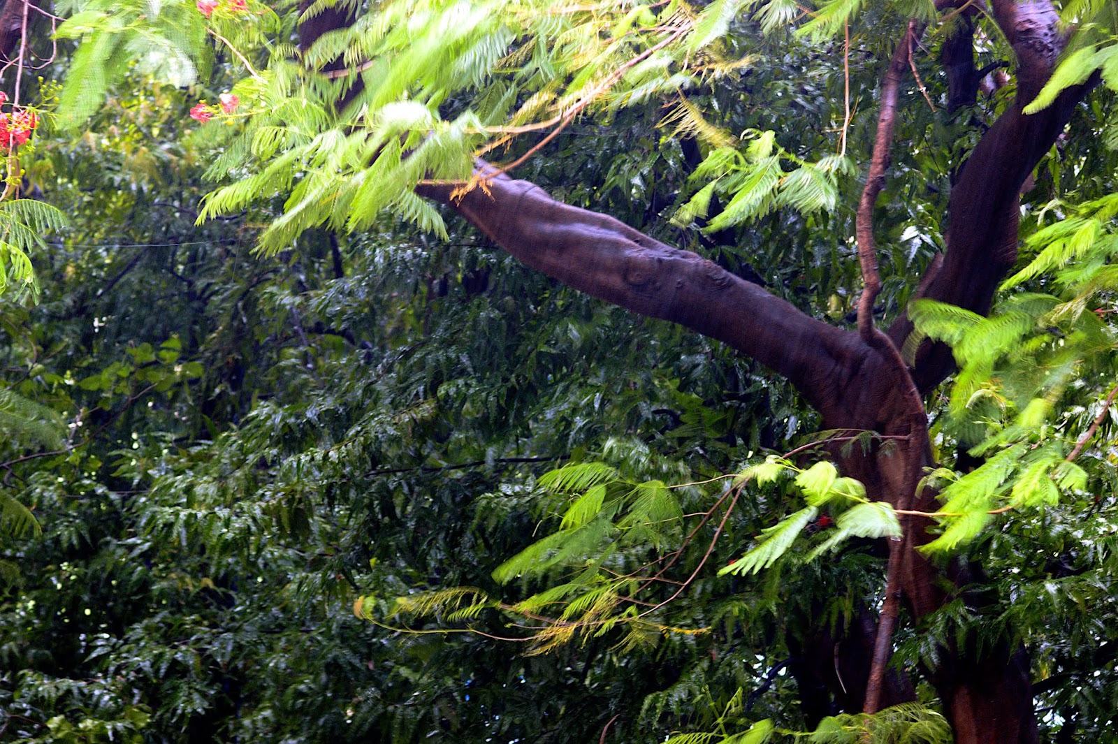
Throughout the city and its surrounding areas, the powerful winds caused street signs to tremble and picked up debris, flinging it around. Downed branches littered sidewalks, and many trees were toppled or significantly damaged, obstructing pathways and creating hazardous conditions. These visible signs of the storm’s intensity were a testament to the powerful gusts that swept through the region.
Specific reports detailed localized yet significant damage. In Gilbert, Arizona, approximately 22 miles southeast of Phoenix, police confirmed “traffic light outages and downed trees across town,” prompting officials to urge residents to avoid travel due to dangerous conditions. The Ahwatukee Foothills area saw a strong wind cause a traffic sign to fall onto a road, further highlighting the widespread nature of the damage. In Chandler, a tree was reported to have fallen on top of a house, with the homeowner also reporting roof damage.
Even private residences felt the storm’s impact. Richard Filley, a retired university professor living in Gilbert, recounted how the dust storm caused trees to sway violently and knocked bird feeders to the ground. He also noted that fine dust found its way through “every little crack and space” into his house, illustrating the pervasive nature of the haboob’s aftermath. Despite the disruption, Filley also acknowledged the “spectacular natural phenomenon” and how they are “kind of beautiful in their own way,” even amidst the damage.
6. **Official Directives and Public Safety: The “Pull Aside, Stay Alive” Mandate**In response to the extreme weather conditions, authorities in Phoenix and across Arizona issued critical warnings and public safety directives, particularly focusing on the severe hazards posed to drivers. The National Weather Service in Phoenix issued comprehensive warnings for dust storms, severe thunderstorms, and flash floods, emphasizing the immediate dangers and urging caution.
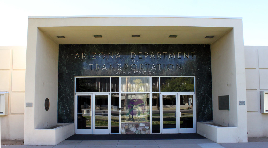
For drivers, the message was clear and urgent: “pull aside, stay alive.” Both the National Weather Service and the Arizona Department of Transportation (ADOT) underscored the peril of dangerously low visibility on major thoroughfares like I-10 and I-17, caused by the dust storm and flooding on roadways. Drivers were advised to proceed with extreme caution and to take immediate action if caught in a dust storm.
The ADOT’s “Pull Aside, Stay Alive” campaign provides specific instructions for motorists encountering such conditions. Drivers are urged to immediately check traffic around their vehicle, slow down, and pull completely off the paved portion of the roadway as soon as safely possible, rather than waiting until visibility becomes too poor. A crucial piece of advice is to turn off all vehicle lights to prevent other vehicles from using them as a guide and potentially crashing into the parked vehicle. Drivers should also set their emergency brake, take their foot off the brake, stay in the vehicle with their seat belt buckled, and wait for the storm to pass. This guidance aims to minimize the risk of collisions in near-zero visibility conditions.
Beyond driving, local authorities also issued broader safety advice. Gilbert police, for instance, urged residents to “avoid travel due to dangerous conditions” and to “drive with caution as we are working diligently to restore lights and clear roadways,” particularly in light of traffic light outages and downed trees across town. These coordinated efforts by various agencies aimed to protect the public from the immediate dangers of the severe weather and facilitate a safer recovery process.
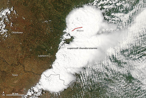
7. **The Meteorology of a Haboob: Unpacking the Desert Phenomenon**Identifying the precise meteorological characteristics of a haboob offers crucial insight into the formidable nature of these dust storms. A haboob is scientifically defined as a dust storm propelled by wind, typically originating from a weather front or the outflow of a thunderstorm, commonly observed in flat, arid regions. It is important to distinguish that while all haboobs are dust storms, not all dust storms fit the specific criteria of a haboob, which are particularly associated with the powerful downdrafts generated by thunderstorms.
These remarkable atmospheric events commence when a thunderstorm collapses, unleashing powerful winds that blast outward from its base. This outward surge of air acts like a gigantic scoop, lifting immense quantities of desert soil from the dry landscape. As the wind gathers the loose earth, it coalesces into a rolling, towering wall of dust, a distinct feature that lends the haboob its dramatic visual impact and destructive force.
Such walls of dust are known to climb thousands of feet into the sky and can extend for miles across the terrain, fundamentally altering the horizon in mere seconds. The visual effect is often likened to a winter blizzard, but composed of fine particulate matter. The sheer density of the airborne dust is so profound that it chokes out natural light, severely reducing visibility to just a few feet in front of oneself during the storm’s peak intensity, rendering immediate surroundings almost entirely obscured.

8. **Haboobs as a Staple of Arizona’s Monsoon Season**Haboobs are not an anomaly within Arizona’s climatic framework; rather, they represent a typical and recurring meteorological phenomenon during the state’s annual monsoon season. While the recent event in Phoenix was notably intense, the occurrence of dust storms is a familiar characteristic of the region’s summer weather patterns. This annual phenomenon is an expected part of the seasonal cycle, highlighting the adaptations required for life in an arid environment.
Arizona’s monsoon season generally spans from mid-June to mid-September, characterized by intermittent thunderstorms that provide a significant portion of the region’s annual precipitation. Historically, Phoenix, a desert metropolis, typically receives approximately 7 inches (18 centimeters) of annual rainfall, with a substantial one-third to one-half of this total accumulating during these on-and-off monsoon thunderstorms. This period is vital for replenishing local water sources and impacting the desert ecosystem.
However, the current monsoon season has presented a different picture for parts of the state. Phoenix has experienced drier-than-usual conditions, receiving just under a quarter inch of rain with the recent storms. Despite the measurable precipitation, the city remains considerably below its annual normal. Conversely, some areas, particularly in southeast and north-central Arizona, have recorded a fair amount of rain, illustrating the geographically varied nature of monsoon rainfall.
According to National Weather Service meteorologist Mark O’Malley in Phoenix, the city had recorded only about 2 inches (5 centimeters) of precipitation by this point in the year, which is more than 2.5 inches (6 centimeters) below normal. This disparity underscores the “hit and miss” nature of monsoon rainfall distribution, where some localized areas may benefit significantly while others remain parched, making overall water management a continuous challenge.

9. **Broader Regional Weather Patterns and Future Forecasts**The broader regional weather patterns indicate that the Southwest monsoon remains active, despite a somewhat slow onset earlier in the season. Meteorologists confirm that the monsoon is now in full swing, bringing vital moisture to an otherwise arid landscape. This surge of monsoonal moisture has been pushing through the area, influenced by a ridge of high pressure that shifted toward the Four Corners region over the recent weekend, creating conditions conducive to storm development.
Looking ahead, the forecast for metro Phoenix includes a continued chance of thunderstorms into Tuesday and Wednesday. However, this threat is expected to ease for the latter half of the week as a shift to a westerly flow is anticipated to introduce drier air, limiting the potential for late-week thunderstorms. Throughout this period, temperatures are projected to build, maintaining the characteristic triple-digit heat of the desert summer, though the monsoonal moisture can offer some temporary relief.
Amidst these dynamic weather shifts, concerns about flash flooding remain prominent. NOAA’s Weather Prediction Center (WPC) had placed portions of southern Arizona under a Level 2 out of 4 flash flood risk on Tuesday, indicating a significant potential for hazardous conditions. Intense rainfall rates, estimated between 1 to 1.5 inches per hour, heighten the risk of rapid water accumulation, particularly in flood-prone areas such as canyons and burn-scar zones, prompting officials to urge vigilance among residents.
Phoenix’s recent storm contributed to what was recorded as its second-wettest day of 2025. Despite this specific event, the city is still experiencing its tenth-driest start to any year, with records extending back to 1895, underscoring the severity of the long-term precipitation deficit. Similarly, Tucson is also enduring its third-driest year to date. This overall lack of rainfall means that while the monsoon brings beneficial precipitation, all of Arizona continues to grapple with varying degrees of drought conditions, making every drop of rain valuable.
Scattered reports of quick water rises from thunderstorms near Camp Verde and Cordes Junction further exemplify the localized yet impactful nature of the ongoing monsoon. The forecast continues to predict more monsoonal thunderstorms across the West on Wednesday and Thursday, indicating that the region will remain under the influence of these complex weather systems, requiring ongoing monitoring and preparedness efforts from both authorities and the public.

10. **Personal Encounters: Fright and Awe Amidst the Dust**The immense haboob that engulfed Phoenix on August 25 provoked a range of visceral reactions, from profound fear to a reluctant appreciation for its natural spectacle. Bernae Boykin Hitesman, driving her 9 and 11-year-old children home from school in Arizona City, approximately 60 miles southeast of Phoenix, vividly recounted her experience. As the storm descended late in the afternoon, she was forced to quickly pull over, finding her car instantly enveloped in the dense dust, rendering visibility so poor that she “couldn’t see [her] hand in front of [her] face if [she] put [her] hand outside.”
Boykin Hitesman described the multi-sensory impact of the event, recalling how she could taste the pervasive dust and feel the vehicle rattling under the force of the strong winds. The experience, which lasted approximately 15 minutes, was deeply unsettling. “I was nervous,” she stated, adding that her children were “really, really scared,” prompting her to maintain a brave demeanor for their sake amidst the swirling chaos.
In Gilbert, a suburb southeast of Phoenix, retired university professor Richard Filley observed the storm’s physical effects on his property. Trees swayed violently under the wind’s assault, dislodging bird feeders from their perches. He noted the pervasive nature of the fine dust, which infiltrated his home through “every little crack and space,” leaving a fine layer across interior surfaces, a common aftermath of such intense dust storms.
Despite the immediate inconvenience and the destructive potential of the wind, Filley also expressed a certain admiration for the phenomenon. “The windstorm part of it, I’m glad it’s gone,” he conceded, but then added, “You look at the photos of haboobs, and they are a spectacular natural phenomenon. They are kind of beautiful in their own way,” highlighting the dual experience of both disruption and awe.
Across downtown Phoenix, the storm’s arrival prompted a flurry of activity as people leaving work reacted with a mixture of “delight and fright” while running from buildings into the torrential downpour. This scene underscored the immediate and often overwhelming impact of such sudden weather events. Furthermore, the Phoenix haboob followed a similar dust storm that impacted the Burning Man festival in Nevada, where strong thunderstorm winds created a dust plume, forcing vendors like Mike Chuda to hastily secure their tents, stating, “We weren’t expecting that. The wind was in such a perfect angle that it was bending our booth forward. So that was pretty wild.” These accounts collectively illustrate the profound and memorable nature of these powerful desert storms on those who experience them.
11. **Beyond the Road: Comprehensive Safety for Various Weather Hazards**While the “Pull Aside, Stay Alive” campaign effectively addresses the critical dangers of driving in dust storms, comprehensive safety during Arizona’s monsoon season extends to various other weather hazards. Authorities consistently emphasize the importance of preparedness for conditions beyond severely reduced visibility on roadways, including heavy rainfall and lightning, which frequently accompany these powerful storm systems. Understanding broader safety protocols is crucial for protecting lives and property across the region.
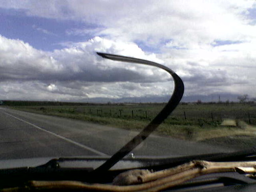
Driving in rain, a common occurrence during the monsoon, presents its own distinct set of challenges and requires specific precautions. The Arizona Department of Transportation (ADOT) advises motorists to inspect their windshield wipers regularly and replace them if necessary before anticipated rainfall. Furthermore, it is critical to turn on headlights to enhance visibility for both the driver and other vehicles, even during daylight hours, as adverse weather conditions diminish ambient light.
When confronted with wet pavement, drivers are urged to reduce their speeds significantly to maintain control and to avoid sudden braking, which can lead to skidding and loss of traction. A fundamental safety practice involves creating an adequate “space cushion” between one’s vehicle and the vehicle ahead, allowing for greater reaction time in slippery conditions. Additionally, motorists should actively avoid areas where water has pooled in travel lanes, as these can obscure road hazards or lead to hydroplaning.
The widespread nature of these storms means that advisories often extend beyond driving conditions. A flood advisory, for instance, was in effect until 9 p.m. on the day of the haboob, underscoring the immediate risk of flash flooding. Such warnings highlight the continuous need for residents to remain vigilant, particularly those in flood-prone areas, including canyons and locations susceptible to post-wildfire burn-scar flooding, where heavy rainfall can rapidly escalate into dangerous torrents.
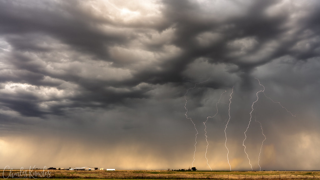
12. **Lightning Safety: Protecting Yourself from Nature’s Electric Fury**As thunderstorms are an integral component of Arizona’s monsoon, understanding lightning safety is paramount. The National Weather Service provides clear guidelines for protecting oneself from this powerful natural phenomenon. A foundational step is to pay close attention to weather cues; the sight of towering cumulus clouds, often referred to as thunderheads, should serve as an immediate signal to seek shelter indoors, indicating an impending thunderstorm.
When lightning threatens, seeking refuge in a safe structure is crucial. A building equipped with plumbing and wiring offers protection, as any lightning strike will typically be conducted safely around and into the ground through these systems. Similarly, remaining inside a vehicle can provide a protective enclosure; the metal frame of the car acts as a Faraday cage, directing electricity from a strike over the vehicle’s exterior and away from occupants.
Conversely, certain actions and locations should be stringently avoided during a lightning storm. Being on open water is exceedingly dangerous, as a boat often represents the most prominent object, significantly increasing the risk of a direct strike. Furthermore, activities like showering or bathing should be postponed, as lightning can travel through plumbing and conduct into the water. Similarly, refraining from using corded or plugged-in electric appliances is advisable, though wireless cell phones and Wi-Fi-connected laptops (when not plugged in) are generally safe for use.
The “30-30 rule” offers a practical method for assessing lightning risk: if thunder is heard within 30 seconds of seeing a lightning flash, the thunderstorm is dangerously close, and immediate shelter should be sought. It is then recommended to wait at least 30 minutes after hearing the last peal of thunder before venturing outdoors again, allowing sufficient time for the storm to dissipate or move away. This rule is vital given that lightning strikes can easily travel 10 miles or more from the main storm, and a record lightning flash in Oklahoma in 2007 traveled nearly 200 miles.
Finally, specific outdoor behaviors can mitigate risk. Never seek shelter under a tree, as a strike to the tree can transfer a dangerous ground charge to anyone underneath. Additionally, if caught outdoors with others, avoid huddling in a group. Maintaining separation can potentially reduce the number of individuals injured if lightning were to strike nearby, emphasizing individual safety in hazardous conditions.
The recent haboob and subsequent storms serve as a potent reminder of the desert’s raw power and the critical importance of being well-informed and prepared for Arizona’s dynamic monsoon season. From understanding the meteorological origins of these dust walls to implementing comprehensive safety measures for driving, heavy rain, and lightning, community resilience hinges on collective awareness and proactive response. As Phoenix navigates its unique climate, embracing these insights ensures that its residents can better withstand and appreciate the extraordinary spectacles nature presents, even amidst their formidable force.

