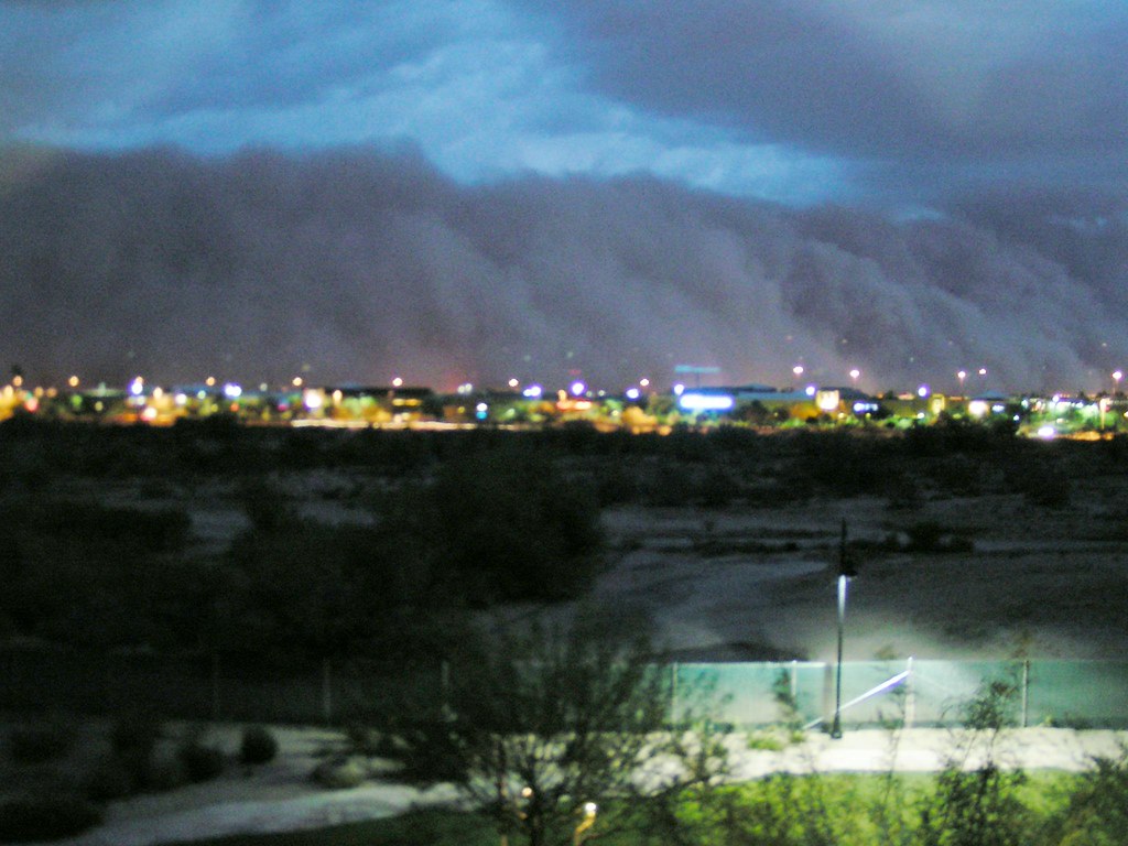
On a seemingly ordinary Monday, August 25, 2025, the skies over Phoenix, Arizona, transformed into a canvas of awe-inspiring, yet terrifying, natural power. A colossal wall of dust, an airborne tsunami, swept through the southwest US city, plunging it into near-total darkness and orchestrating a dramatic spectacle that left residents both stunned and scrambling for safety. This wasn’t merely a dust storm; it was a haboob, a meteorological marvel that momentarily redefined the horizon and reminded all who witnessed it of nature’s raw, untamed might.
These formidable natural phenomena are a common occurrence during the arid region’s monsoon season, yet each one carries a unique signature of power and disruption. What makes a haboob so profoundly impactful isnies not just its sheer size – towering thousands of feet and stretching for miles – but its sudden onset and the near-zero visibility it creates, turning familiar landscapes into disorienting, hazy voids. The event in Phoenix was a stark reminder of these storms’ capacity to disrupt daily life, ground flights, halt traffic, and cut power to tens of thousands.
In this in-depth exploration, we delve into the heart of the August 2025 Phoenix haboob, dissecting its origins, understanding its intricate mechanics, and chronicling the immediate and far-reaching consequences it wrought upon the vibrant desert metropolis. We will journey through the scientific definitions, explore the unique characteristics that distinguish these dust storms, and recount the initial chaos that enveloped Phoenix, from the paralyzed airport to the widespread power outages, providing a vivid picture of what it means when an airborne giant descends.
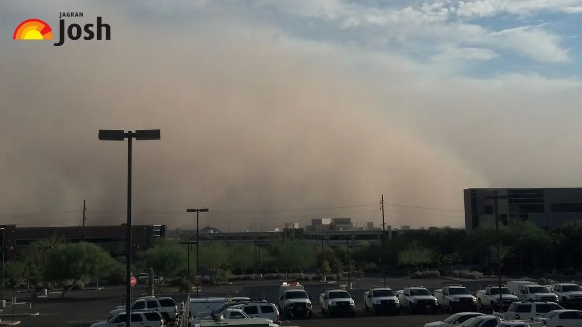
1. **What is a Haboob? Defining the Phenomenon**A haboob is not just any dust storm; it is an intense, dramatic meteorological event, characterized by a massive, rolling wall of dust and sand driven by powerful winds. The term itself, ‘haboob,’ finds its roots in the Arabic word ‘haab,’ meaning “wind” or “blow,” a linguistic legacy reflecting its long-documented presence in regions like the Middle East and North Africa. These aren’t merely localized gusts, but rather towering, advancing fronts of particulate matter that command attention.
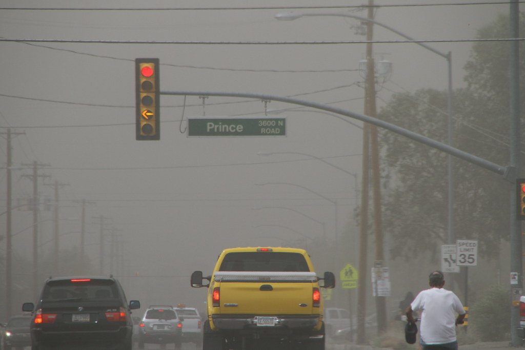
What truly sets a haboob apart is its profound impact on visibility, often reducing it to near-zero conditions within moments. This sudden envelopment creates a disorienting, almost surreal environment, where landmarks vanish and the familiar world becomes obscured by a choking veil of dust. Such conditions pose immediate and severe hazards, making any outdoor activity, especially driving, incredibly perilous as the world outside the windshield disappears into a uniform brown.
The scale of a haboob can be truly breathtaking. These walls of dust are known to climb thousands of feet high, often reaching up to 10,000 feet, and can stretch for many miles across the landscape. As they advance, they appear to swallow everything in their path – vast expanses of desert, critical infrastructure, and even entire communities – painting an apocalyptic-like scene reminiscent of a science-fiction film. They are a potent combination of thunderstorms, high winds, and airborne dust, most frequently occurring in the hot, dry, arid areas that are prone to drought.
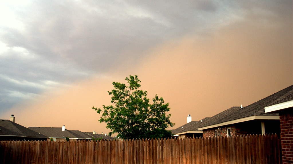
2. **The Science Behind Their Formation**Haboobs do not simply materialize; they are triggered by a very specific set of atmospheric conditions, predominantly the outflow winds generated by collapsing thunderstorms in arid or semi-arid regions with loose, dry soil. Unlike ordinary dust storms that might be kicked up by general high winds, the genesis of a haboob is intimately tied to the dynamics of a severe weather system. This connection is crucial to understanding their sudden onset and immense power.
The formation process begins when air is forced downward and outward from the front of a moving thunderstorm. This phenomenon occurs through powerful downdrafts, where cool air rushes rapidly toward the ground. This cooling is often a result of evaporative cooling, as precipitation falls through dry air, causing some of it to evaporate and cool the surrounding air mass, which then becomes denser and descends with considerable force.
As these downdrafts crash onto the desert floor, they spread outward, creating what are known as outflow winds. These winds can be remarkably strong, sometimes exceeding 60 mph. As they blast across the dry landscape, they efficiently scoop up vast quantities of loose dust, sand, and debris, building them into a dense, advancing wall of particles that marches across the terrain. These storms are a common feature during monsoon seasons, a period when moist air frequently converges with heated ground surfaces to generate thunderstorms, particularly evident in the southwestern United States from June through September.
Several environmental factors contribute to the intensity of a haboob. The presence of dry soil and sparse vegetation are critical, as they leave the ground exposed and the topsoil easily mobilized by wind. Furthermore, human activities such as farming, construction, and other forms of land disturbance can significantly increase the availability of loose material, providing ample fuel for these dust storms to intensify. Once formed, a haboob typically moves swiftly, lasting anywhere from 10 to 30 minutes, though the finer dust particles can linger in the air for hours, continuing to affect air quality and visibility long after the main front has passed.

3. **Distinctive Characteristics of a Haboob**The defining characteristics of haboobs are as dramatic as their appearance. Their sudden onset is one of the most striking features; one moment the sky can be clear, and the next, a towering wall of dust is visible on the horizon, rapidly approaching. These walls are not merely tall; they can be several thousand feet high and stretch for many miles wide, creating an intimidating and awe-inspiring natural barrier that redefines the landscape.
Accompanying this visual spectacle are formidable wind gusts, frequently exceeding 50 mph, and sometimes reaching as high as 70 mph, which are powerful enough to lift substantial debris and even topple trees. The most critical and hazardous characteristic, however, is the precipitous drop in visibility. This can plummet to a quarter-mile or less within seconds, often leading the National Weather Service to issue urgent Dust Storm Warnings. Drivers are particularly vulnerable as their field of vision rapidly diminishes, making it almost impossible to discern the road ahead or other vehicles.
As the leading edge of a haboob passes, observers often experience a sharp, noticeable temperature drop, accompanied by the intense, swirling winds. This is quickly followed by the main body of the storm: a thick, choking blanket of dust. This dust isn’t just a visual nuisance; it can contain fine particulate matter, such as PM10, which significantly affects air quality and poses health risks. The air becomes heavy and gritty, a palpable presence that seeps into every crevice.
While incredibly intense, haboobs are typically brief events, usually lasting only a few minutes to an hour. However, their short duration belies the immediate and severe hazards they present during their passage. Meteorologists track these events diligently, as haboobs often appear on radar as distinct outflow boundaries emanating from thunderstorms. This identifiable signature allows weather services to issue timely warnings, providing crucial moments for residents to take protective actions against the approaching dust wall.
4. **Global and Regional Occurrence: Where Haboobs Strike**Haboobs are not an isolated phenomenon; they are common occurrences across arid and semi-arid regions throughout the world, testament to the universal interplay of dry landscapes and powerful weather systems. These striking dust storms are frequently observed in vast desert expanses such as the Sahara Desert, the Arabian Peninsula, and parts of North Africa and the Gulf of Guinea. In southern Arabia, for instance, they often manifest as immense walls of sand and dust, intricately tied to the broader regional wind patterns and climatic conditions.
Within the United States, the Southwest stands as a primary hotbed for haboob activity. Arizona’s Sonoran Desert, a landscape intimately familiar with extreme temperatures and dry conditions, is particularly susceptible. Phoenix, a sprawling urban center nestled within this desert, experiences these dramatic events with notable regularity, typically encountering one to three major haboobs annually. Looking at the wider state, Arizona has reported over 100 dust storms in the past decade, underscoring the commonality of these airborne giants in the region.
Beyond Arizona, other parts of the US also contend with these formidable dust storms. Hotspots include portions of New Mexico, Texas, and Colorado, where the combination of arid land and thunderstorm activity creates ripe conditions for haboob formation. Even regions like central and eastern Washington can experience haboobs, particularly during the spring through fall seasons, demonstrating that while often associated with classic desert environments, their reach can extend to other dry, open landscapes with suitable meteorological triggers.
5. **The Phoenix Event of August 25, 2025: A City Engulfed**The afternoon of Monday, August 25, 2025, etched itself into the collective memory of Phoenix residents as a monumental haboob swept through the city. What began as a distant, ominous brown line on the horizon rapidly escalated into a massive wall of dust, effectively plunging the southwest US city into near-total darkness. The sheer scale and speed of the storm were astonishing, transforming the vibrant desert cityscape into a disorienting tableau as if swallowed whole by an encroaching, tangible shadow.
Images and videos captured the terrifying beauty of the phenomenon, with a towering cloud of dust looming over planes at Phoenix Sky Harbor International Airport, a sight that many described as reminiscent of a science-fiction film. As the haboob consumed homes and infrastructure, video footage depicted an apocalyptic-like scene, where the city and its surrounding areas were engulfed, accompanied by the rumbling thunder that hinted at the powerful storms brewing within the dust wall itself. The City of Phoenix, through its social media channels, succinctly warned, “This monsoon dust isn’t messing around…Please be safe!” acknowledging the profound danger at hand.
This gigantic wall of dust was not an isolated event; it was quickly followed by a series of severe thunderstorms, accompanied by heavy rain and intense lightning, which triggered flash flood warnings across the region. The combined fury of dust and subsequent storm left a trail of disruption. Reports confirmed numerous downed trees, significant wind damage, and widespread power outages across the metropolitan area. The National Weather Service (NWS) underscored the vast reach of the event, estimating that in all, more than two million people were directly affected by the haboob and the subsequent weather.
6. **Phoenix Sky Harbor Airport: Grounded by Dust and Wind**One of the most immediate and visible impacts of the August 25th haboob was the severe disruption it caused at Phoenix Sky Harbor International Airport, a crucial transportation hub for the region. As the massive cloud of dust approached, seeming ready to swallow the facility whole, airport authorities were compelled to enact a ground stop. This critical safety measure prevented any planes from leaving or landing, effectively paralyzing air travel for a significant period.
Airport spokesperson Gregory E. Roybal confirmed that for approximately an hour, all operations were halted. Even after the immediate passage of the haboob, the impact lingered, with the airport experiencing up to 30-minute delays late Monday night as crews diligently assessed any potential damage or roof leaks caused by the storm. This led to considerable inconvenience for travelers, with more than 200 delays reported at the airport, and KPHO-TV additionally reported that three flights were cancelled outright due to the conditions.
Beyond flight disruptions, the airport sustained physical damage from the intense winds that accompanied the haboob and the subsequent thunderstorms. Local media reported that the weather tore part of the roof off Phoenix Sky Harbor Airport, a clear indication of the storm’s destructive force. Furthermore, a connector bridge at the airport was notably shredded by 70 mph wind gusts, highlighting the extreme pressures exerted by the atmospheric onslaught. Video footage sent to KPHO-TV provided visual evidence of the damage to the roof in Terminal 4. Airport deputy aviation director for public relations, Heather Shelbrack, confirmed that “Crews have been identifying leaks and attempting to clean up water where it has collected in passenger areas,” underscoring the extensive cleanup efforts required in the aftermath of such a powerful event.
7. **Widespread Power Outages: Darkening Maricopa County**As the haboob and subsequent thunderstorms swept through the Phoenix metro area, one of the most immediate and widespread consequences for residents was the loss of electricity. The powerful winds and heavy rain left tens of thousands of utility customers without power, with the vast majority of these outages concentrated within Maricopa County, the most populous county in Arizona which includes Phoenix itself. The disruption was not merely inconvenient; it posed significant challenges for daily life and safety across the affected communities.
Initial reports from various utility providers painted a clear picture of the scale of the outages. The Trico Electric Co-op, for instance, reported that 7,200 customers were without power. Broader assessments indicated that more than 15,000 people lost electricity, predominantly within Maricopa County, according to PowerOutage.us. As the evening progressed, the numbers grew, with ABC15 Arizona reporting that over 50,000 utility customers were without power in Phoenix and Pinal County following the monsoon dust and rainstorms. By 7:30 PM, approximately 52,000 people remained without electricity, with the SRP outage map showing over 47,400 affected customers and the APS outage map reporting about 9,000 impacted.
Beyond individual homes and businesses, the power outages had cascading effects on public infrastructure. In Gilbert, a town about 22 miles southeast of Phoenix, police reported “traffic light outages and downed trees across town,” emphasizing the hazardous driving conditions created by the storm’s aftermath. These conditions made travel treacherous, prompting authorities to urge residents to avoid non-essential journeys. Further testament to the storm’s destructive path included a traffic sign falling onto the road in the Ahwatukee Foothills area and, in Chandler, a homeowner reporting roof damage after a tree fell on top of their house, illustrating the broad impact across various communities in the region.
8. **Driving in a Haboob: The Peril of Reduced Visibility**One of the most immediate and profound dangers posed by a haboob is the extreme hazard it creates for motorists. As the towering wall of dust approaches and envelops an area, visibility can plummet to near-zero conditions within moments, turning familiar roadways into disorienting, perilous corridors. The suddenness of this transition leaves little time for drivers to react, often trapping them in a thick, choking cloud where discerning the road ahead or other vehicles becomes virtually impossible. This makes the simple act of driving extraordinarily dangerous, underscoring the urgent advice from authorities to ‘pull aside, stay alive.’
During the August 25, 2025 event, the impact on major thoroughfares was stark and immediate. The Arizona Department of Transportation reported that visibility on the crucial I-10 highway was reduced to just dozens of feet, creating white-knuckle conditions for anyone still on the road. Similarly, the I-17, another busy roadway, faced partial closures not only due to the dust storm itself but also because of subsequent flooding. These reports highlight how quickly major arteries can become impassable, transforming routine commutes into life-threatening situations where the world outside the windshield literally disappears.
Faced with such treacherous conditions, the National Weather Service (NWS) and local transportation departments issue unequivocal guidance: if caught in a haboob while driving, the safest course of action is to pull off the road immediately. It is critical to turn off all vehicle lights, including headlights, tail lights, and emergency flashers, to avoid misleading other drivers who might mistake illuminated lights for a moving vehicle. Instead, setting the emergency brake is advised. This crucial advice, part of the widely successful ‘Pull Aside, Stay Alive’ campaign, aims to prevent potentially catastrophic chain-reaction collisions in an environment where visual cues are nonexistent.
Indeed, the effectiveness of these public awareness campaigns has been empirically noted. A study conducted in Phoenix between 2009 and 2017 revealed a 17% drop in motor vehicle collision-related emergency visits during the six hours following a haboob’s onset, a testament to the life-saving impact of driver education. While the overall number of incidents might decrease, the severity of those that do occur can be high, with the study also indicating that injuries were more common among men and often associated with higher mortality rates, underscoring the critical importance of adhering to safety protocols.

9. **Historical Precedents: Notable Haboob Events Beyond Phoenix**While the August 2025 Phoenix haboob garnered significant attention due to its scale and urban impact, these formidable dust storms are a consistent feature of arid regions worldwide and have a rich history of dramatic occurrences. Phoenix itself is no stranger to these events, experiencing typically one to three major haboobs annually as part of its monsoon season. Looking at the wider state, Arizona has reported over 100 dust storms in the past decade, underscoring the commonality and persistent nature of these airborne giants in the region. These regular occurrences provide a context for understanding the long-term interaction between desert communities and their natural environment.
Beyond the familiar landscapes of the American Southwest, haboobs have left their mark across diverse geographical settings. In 2014, a notable Colorado Dust Storm occurred, demonstrating that these phenomena are not exclusive to classic desert environments. Triggered by a cold front, this event produced winds up to 50 mph, creating a massive dust wall that was visible even from space. This particular haboob served as a powerful reminder that specific atmospheric conditions, rather than just extreme heat, can produce these towering dust fronts in areas not traditionally associated with vast sandy deserts, expanding our understanding of their potential reach.
Another significant event, the High Plains Haboob of October 2020, further highlighted the ability of these storms to extend their influence into non-arid regions. During this event, strong winds lifted dust to great heights across the US High Plains, showcasing the storm’s impressive vertical and horizontal reach. More recently, in June 2024, a massive haboob swept across New Mexico, captured in stunning aerial video footage that emphasized the storm’s immense scale and rapid speed, providing contemporary visual evidence of these natural spectacles and their capacity to engulf vast areas.
These historical precedents, combined with Phoenix’s ongoing experience during monsoon seasons, reveal a recurring pattern of nature’s power. Meteorologists and researchers have documented a decade of such events crossing the state of Arizona, often through time-lapse videos, turning them into subjects of both scientific study and public fascination. Each event, while unique in its specifics, reinforces the broader understanding of haboobs as powerful, widespread, and recurrent meteorological phenomena that demand our respect and preparedness, shaping the landscapes and lives in their path across various regions of the world.
10. **Mitigation Strategies: Early Warnings and Land Management**Effectively living with the recurring threat of haboobs requires more than just understanding their formation and impacts; it demands robust mitigation strategies focused on early detection, public awareness, and environmental stewardship. Paramount among these is the role of early warnings issued by meteorological agencies. The National Weather Service (NWS) is critical in this regard, issuing specific alerts such as Dust Storm Warnings, Severe Thunderstorm Warnings, and general advisories as these systems develop and approach populated areas. These timely alerts are not merely informative; they provide crucial moments for residents to take protective actions, whether it’s pulling off the road or securing their homes.
Beyond immediate warnings, proactive land management practices play a significant, long-term role in reducing the intensity and frequency of haboobs. In arid and semi-arid regions, where loose, dry soil is abundant, strategies such as planting vegetation are vital. By stabilizing the soil, vegetation acts as a natural barrier against wind erosion, thereby reducing the amount of particulate matter available to be scooped up by powerful thunderstorm outflow winds. This highlights an ecological approach to mitigation, addressing the root causes of dust mobilization rather than just reacting to its effects, fostering a more resilient landscape.
Public awareness campaigns have also proven remarkably effective in minimizing the hazards associated with haboobs. Arizona’s highly successful ‘Pull Aside, Stay Alive’ initiative stands as a prime example, providing clear, concise instructions for drivers caught in rapidly deteriorating visibility. The efficacy of such campaigns is tangible; a study in Phoenix from 2009 to 2017 revealed a 17% drop in motor vehicle collision-related emergency visits in the six hours after a haboob began. This demonstrates that well-communicated public education can significantly alter behavior and reduce injuries, transforming awareness into life-saving action. Preparation and awareness are not abstract concepts but crucial tools in the arsenal against these airborne giants.
These combined efforts—sophisticated meteorological forecasting, thoughtful environmental practices, and targeted public outreach—form a comprehensive framework for coexisting with haboobs. While the raw power of these natural phenomena cannot be entirely controlled, their risks can be substantially managed. This multi-faceted approach ensures that communities in haboob-prone regions are not just reactive but are equipped with the knowledge and tools to anticipate, prepare for, and respond effectively to the dramatic arrival of these towering walls of dust, safeguarding lives and minimizing disruption.
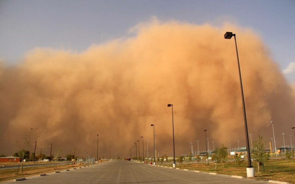
11. **Essential Safety Measures: What to Do When a Haboob Strikes**When a haboob is on the horizon, or worse, has already enveloped your location, immediate and decisive action is paramount for safety. The most critical piece of advice, especially for those in vehicles, comes from the National Weather Service: ‘pull aside, stay alive.’ If you are driving and encounter a dust storm, the primary directive is to pull completely off the paved portion of the roadway. Crucially, do not stop on the highway itself, as this creates an immense hazard for other drivers who may not see your vehicle in the near-zero visibility conditions.
Once safely off the road, it is imperative to turn off all vehicle lights. This includes headlights, tail lights, and even emergency flashers. The rationale is simple yet life-saving: in such thick dust, an illuminated vehicle might be mistaken for a moving one by another driver, potentially leading to a collision. Instead of relying on lights, set your emergency brake to ensure your vehicle remains stationary. This complete cessation of visibility and movement is the safest strategy until the main dust front has passed and some visibility is restored, typically within 10 to 30 minutes for the leading edge of the storm.
For those not in a vehicle, or who have found shelter indoors, the focus shifts to minimizing exposure to the fine particulate matter carried by the haboob. Staying indoors with windows and doors securely sealed is essential to prevent dust intrusion, which can be pervasive, as noted by residents who reported dust seeping through ‘every little crack and space.’ Utilizing air filters can further reduce the inhalation of airborne dust, protecting respiratory health. This comprehensive approach to indoor safety helps mitigate the health risks associated with poor air quality and ensures that the home remains a true sanctuary from the storm.
Ultimately, preparation and awareness are the cornerstones of haboob safety. While a haboob’s wall of dust can often be seen approaching from a distance, by the time it reaches your immediate vicinity, it is often too late to seek shelter if you are behind the wheel. Therefore, heeding early warnings, understanding the distinct characteristics of these storms, and knowing precisely how to react in the critical moments of their arrival are not just recommendations, but essential life-preserving protocols that empower individuals to navigate the unpredictable fury of an airborne tsunami.
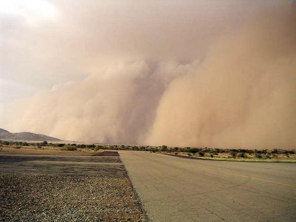
12. **The Monsoon’s Continued Embrace: Phoenix’s Ongoing Weather Story**Even as Phoenix residents began to grapple with the aftermath of the monumental August 25, 2025 haboob and subsequent thunderstorms, the dynamic weather patterns of the Southwest monsoon season continued their powerful influence. The National Weather Service (NWS) forecast for the days immediately following the event indicated a continued chance of isolated thunderstorms from Tuesday through Thursday. This highlights the typical nature of monsoon activity, where periods of intense weather can be followed by further atmospheric instability, keeping communities on alert for continued rain, lightning, and wind.
However, the forecast also offered a glimpse of transition, predicting a return to drier conditions by Friday. Concurrently, the region anticipated a building heat throughout the week. Interestingly, the NWS explained that this building heat, combined with dry air, would likely limit the potential for late-week thunderstorms, illustrating the delicate balance of atmospheric conditions that govern monsoon activity. This intricate interplay means that while the immediate threat of further severe storms might ease, the enduring desert heat remains a constant companion.
Despite the significant rainfall that can accompany these storms, Phoenix itself picked up just under a quarter-inch of rain with the storms on Monday. This amount, while beneficial, underscores the often localized and ‘hit and miss’ nature of monsoon precipitation, as noted by meteorologists. Even with the powerful events of the 25th, the Southwest monsoon pattern isn’t quite done yet for the season, reinforcing that such dramatic weather is an inherent, albeit unpredictable, part of living in this arid region, where moist air frequently converges with heated ground surfaces to generate thunderstorms.
As the skies slowly clear and the dust settles, Phoenix and its surrounding communities remain locked in a perpetual dance with their desert environment. The August 2025 haboob, an airborne tsunami that momentarily swallowed the city, served as a potent reminder of nature’s raw, untamed might. Yet, through advanced forecasting, robust mitigation efforts, and the resilient spirit of its residents, this vibrant desert metropolis continues to adapt, understanding that these spectacular and sometimes terrifying natural phenomena are not just events to endure, but integral elements of the unique and awe-inspiring landscape they call home.

